
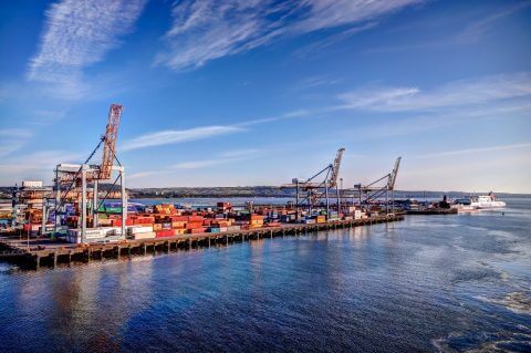
New port decarbonisation demonstrator project launched with ESA
Geospatial Insight is leading the CACHE Net Zero (Clean Air Clean Harbour Energy for Net Zero) project, co-funded by the European Space Agency (ESA), which empowers ports to effectively plan, implement and then monitor key actions that will deliver reductions in air pollution and carbon emissions associated with harbour operations.
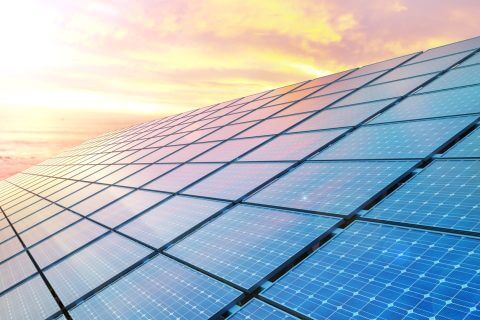
LOCATE SOLAR launch helps councils deliver on net zero strategies
Geospatial Insight, the UK’s leading provider of clean energy geospatial solutions, has launched the next phase of their LOCATE platform, LOCATE SOLAR, the most detailed, comprehensive, and up-to-date national rooftop solar sustainability database, containing over 23,000,000 individual building entries each with over 20 unique solar-centric attributes.
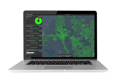
Essex County Council identifies rooftop potential using LOCATE SOLAR
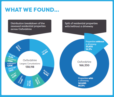
Essex County Council is responsible for over 3,600sqkm of land, 750,000 buildings and in excess of over 1.5 million people. In 2020 the Authority launched a dedicated Essex Climate Action Commission. The Committee released the Essex Climate Action Plan in November 2021, with the aim of making the entire county Carbon Net Zero by 2050.
The Latest News from Hexagon EMEA Resellers
Last month we attended the Hexagon EMEA Reseller Meeting in Mallorca – it has been a couple of years since we’ve actually been able to meet in person and so it was a great opportunity to catch up with both the Hexagon team and Resellers from across the region.

A day in the life of a geospatial consultant
As a Geospatial Insight consultant no two days are quite the same. Each one brings new challenges and opportunities to provide critical support to a range of clients across different industries. As someone with a background in the British Army, I am used to working in high-pressure situations, and my role at Geospatial Insight is no different.
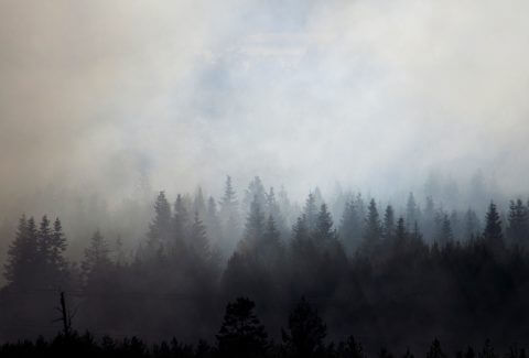
Using ERDAS Imagine to detect wildfires
Greenland is not traditionally thought of as a wildfire-prone region, however the number and size of fires across the Arctic region is known to be increasing. This includes the widely reported large tundra fires in western Greenland during the summer in 2017 and 2019. These paint the picture of a changing fire regime in a rapidly warming part of the world.

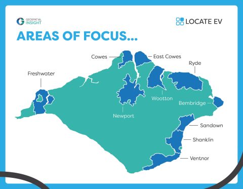
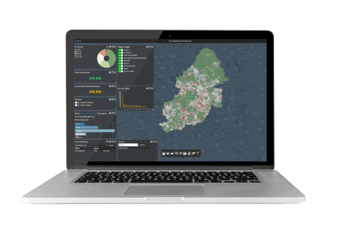
Isle of Wight EV charging strategy infographic
Download the full infographic here DOWNLOAD