Image Analysis and GIS Software

The geospatial, remote sensing and data management solutions offered by Hexagon are leading edge technologies designed to build powerful applications and create innovative cloud-based solutions. From transforming raw geospatial data into insightful information, to designing, developing and delivering lightweight targeted applications, Hexagon provides all the tools needed to solve specific business problems.

Services


As a Hexagon UK Platinum Partner, we deliver world class software, training and consultancy, allowing our clients to transform raw data into geospatial information, manage data catalogues, and deliver targeted applications designed to solve their specific business needs.

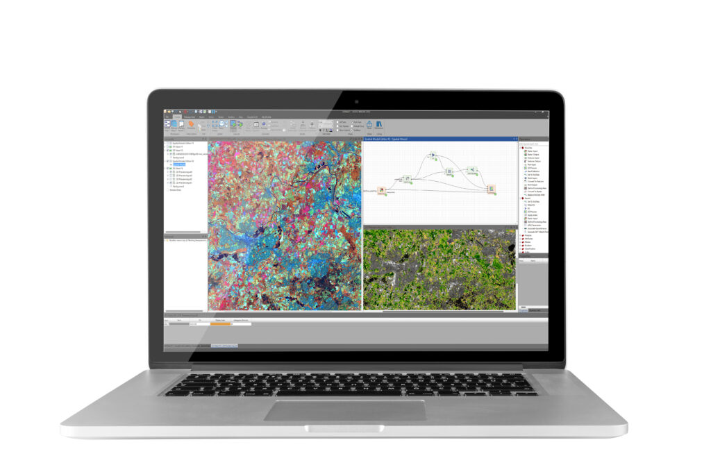
At the heart of the desktop products is ERDAS IMAGINE, the world leading comprehensive image analysis suite, combining remote sensing, photogrammetry, lidar analysis, vector analysis, and radar processing into one product.

The M.App Enterprise platform enables the creation of visual applications, storing geospatial data and providing the dynamic delivery of geospatial analytics and workflows to enhance business intelligence. ERDAS APOLLO is an extensive data management, analysis and delivery system allowing data to be distributed from the cloud or an in-house server.

Ready to get in touch?

EXPLORE OUR RANGE OF HEXAGON SOLUTIONS

ERDAS IMAGINE

The world leading geospatial data authoring system for remote sensing, photogrammetry and geospatial analysis
Learn More

ERDAS IMAGINE Add-Ons

Enhanced imagery analysis: change detection, image registration, 3D visualisation, stereo support, feature extraction
Learn More

IMAGINE Photogrammetry

A seamlessly integrated collection of software tools that allow the creation and editing of elevation layers from stereo data
Learn More

M.App Enterprise

The office-to-field solution for delivering business intelligence tools, 2d and 3d mapping and infographics
Learn More

ERDAS Apollo

A flexible, integrated enterprise system to securely manage, discover and deliver raster and vector data
Learn More

GeoMedia

A powerful GIS that can extract information from dynamic datasets to support smarter decision making
Learn More

Download

Have a Look at our all Hexagon Product Sheets

GO TO DOWNLOADS

Case Studies

Using Satellite Technology to Improve the Speed and Accuracy of Credit Lending Decisions

With over a decade’s experience in developing bespoke solutions for clients in the insurance, investment,…

FIND OUT MORE

Spatial Modeller

Learn how Spatial Modeller allows the easy creation, modification and visualisation of complex geospatial workflows

Introduction to ERDAS IMAGINE Spatial Modeler 1

Watch Here

Introduction to ERDAS IMAGINE Spatial Modeler 2

Watch Here

Introduction to ERDAS IMAGINE Spatial Modeler 3

Watch Here

Introduction to ERDAS IMAGINE Spatial Modeler 4

Watch Here

M.App Enterprise

Learn how to create cloud based applications with the flexibility of linking to any spatial data source

Getting Started with M.App Enterprise 1

Watch Here

Getting Started with M.App Enterprise 2

Watch Here

Getting Started with M.App Enterprise 3

Watch Here

Getting Started with M.App Enterprise 4

Watch Here

Request a demo

Fill The Form Out Below And One Of Our Sales People Will Be In Touch Shortly

Interested In Buying Our Products?

Fill The Form Out Below And One Of Our Sales People Will Be In Touch Shortly