Ask a Question

MotionMonitor

Land stability is key to the development, construction, and long-term operations of critical infrastructure. MotionMonitor delivers continuous, satellite-based ground movement surveillance to detect subtle displacement trends preemptively, ensuring project integrity and safeguarding investments throughout the project lifecycle.

MotionMonitor logo in bold modern typography, representing infrastructure and asset monitoring solutions.

Solution


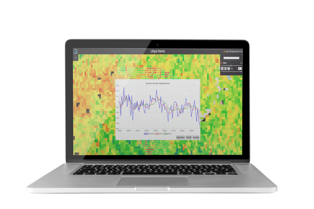
MotionMonitor provides satellite-based monitoring of ground movement, enabling organisations to identify risks early and protect critical infrastructure. By detecting subtle movements before they escalate, costly structural failures can be avoided, safeguarding investment, supporting safer construction and enabling long-term operations.

Powered by APSIS (Advanced Pixel System using ISBAS), a unique InSAR algorithm co-developed with the University of Nottingham and Terra Motion, MotionMonitor delivers millimetre-level accuracy and up to 2–8× higher measurement density in urban areas, and 7–15× in vegetated or complex terrains when compared to traditional InSAR techniques.

Ready to get in touch?

Laptop mock-up showing dashboard with charts, graphs and map views for monitoring infrastructure and assets.

Benefits

Warning sign icon representing near real-time alerts.

Detect Risks
Early

High-resolution tracking enables identification of ground movement before a failure occurs

A icon of a group of people in a circle representing decision making.

Inform Decisions with Confidence

Visualised trends and historic data support proactive risk assessment and validation of design assumptions

Icon combining a thumbs up and a coin to show reduced intervention and costs.

Reduce Intervention & Costs

Satellite-based monitoring eliminates the need for ground instruments, cutting costs and minimising disruption

Icon of a house with a medical cross inside to represent strengthening resilience.

Strengthen Resilience

Continuous monitoring safeguards infrastructure integrity, supports strategic planning, and builds stakeholder trust

Features

A icon of hills, tree and sun to represent full terrain coverage.

Full Terrain Coverage

Uniquely detects ground movement across all surfaces, including vegetated and urban areas, providing comprehensive oversight

Icon of a target and inside is a exclamation mark to represent millimetric precision.

Millimetric Precision

APSIS InSAR delivers high-density, millimetre-scale displacement measurements for reliable monitoring

Icon of a magnifying glass viewing a graph to represent trend and risk insight.

Trend & Risk
Insight

Time-series visualisation of surface movement, including inverse velocity mapping, supports deeper risk understanding

Icon of half a cog with data points coming off of it to represent data integration efficiency.

Data Integration Efficiency

Efficient integration of diverse data sources for comprehensive monitoring

Check out the Latest Insights and Updates from the Geospatial Insight Team

Learn More

Request a demo

Fill The Form Out Below And One Of Our Sales People Will Be In Touch Shortly

Interested In Buying Our Products?

Fill The Form Out Below And One Of Our Sales People Will Be In Touch Shortly