KeighleyH
Beirut CAT Response
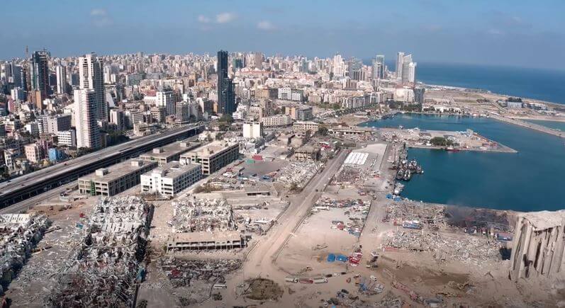
The drone imagery from a commissioned flight over Beirut, collecting visual evidence to complete a…

An Introduction to VIP
An overview of our visualisation platform – VIP

How to Create an NDVI Dataset in ERDAS IMAGINE
A quick tutorial video explaining how to produce an NDVI data set in Hexagon Geospatial…