Geospatial Insight launched their MOTIONMONITOR solution last year, facilitating the regular monitoring of key Tailing Storage Facility (TSF) locations and providing warning of potential failure. Since then, they have been implementing additional features into their visual dashboard to enhance the user experience.
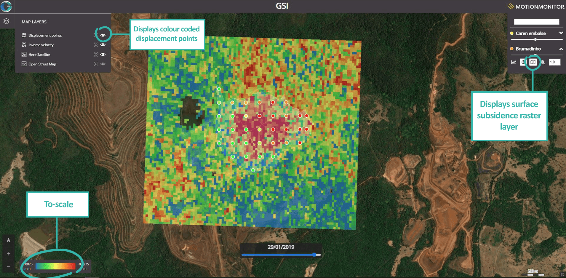
Utilising Sentinel-1 Single Look Complex data in correlation with a unique data processing methodology, known as APSIS™, interferometry displacement measurements can be calculated. MotionMonitor displays this information as points over time – colour coded to demonstrate the level of surface movement at a glance. Each point can be interrogated to show a more in-depth understanding of the displacement measurements via a line graph, as well as a short-term and long-term moving average of the displacement.
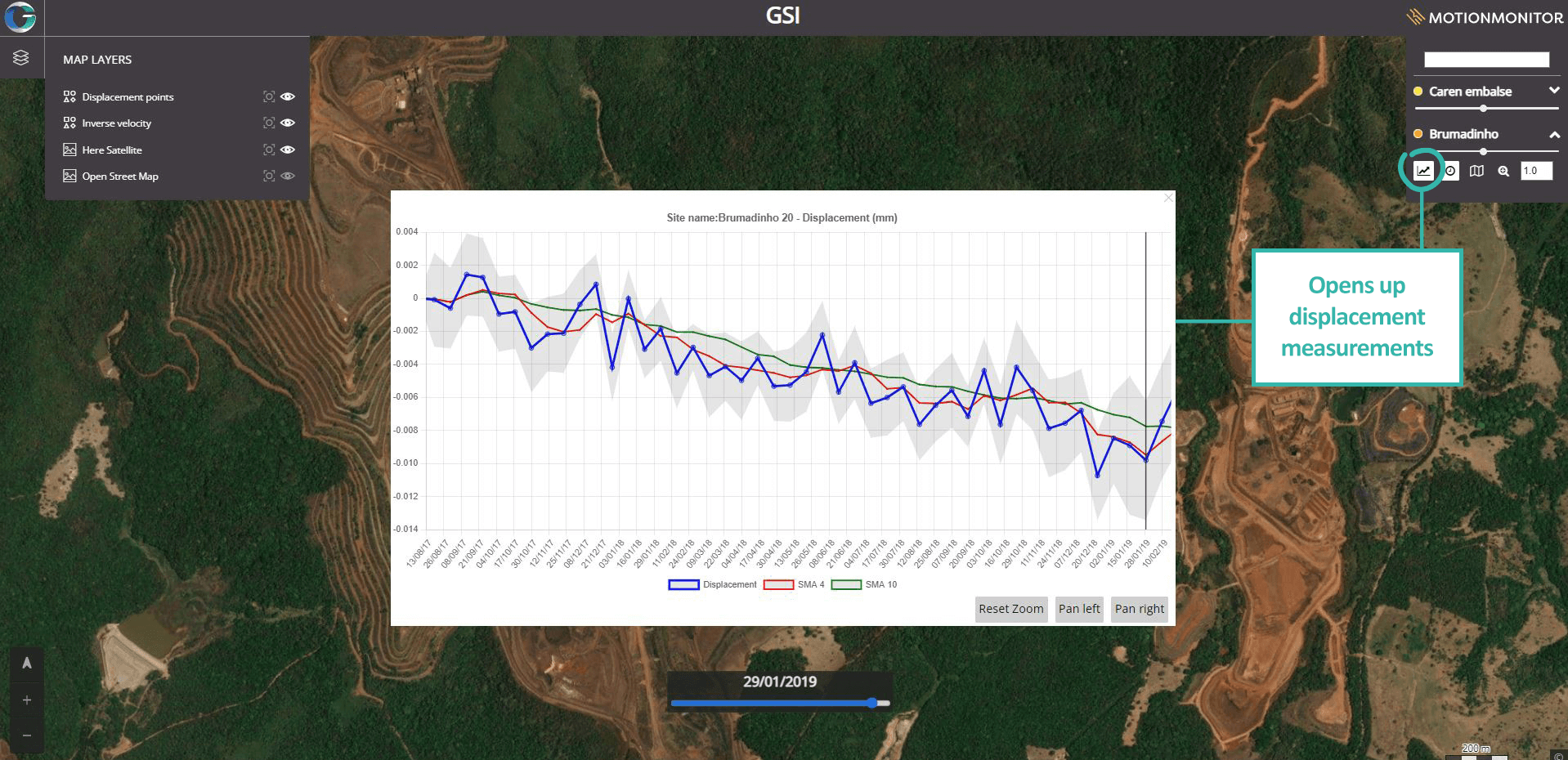
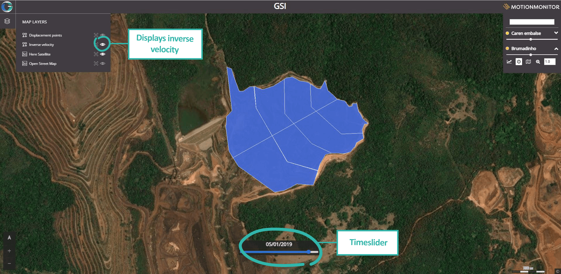
The millimetric surface movement beneath and surrounding TSF locations can also be viewed via a detailed and to-scale raster layer – highlighting areas with increasing surface subsidence, which may be of concern. The inverse velocity of the site is also determined and displayed over an extended time period and provides a more detailed understanding of the landscape, potentially contributing supporting insight into future surface movement in and around any given location.
Knowing that each clients’ requirements may vary drastically, individual user dashboards can incorporate bespoke modifications. This could include:
- Data sources through external subscriptions such as Google base maps and Google imagery
- Privately sourced imagery datasets such as drone footage or ground imagery
- Additional point features or polygon layers
As well as having the opportunity to add in additional layers and datasets, each dashboard can house multiple site locations across the globe, meaning clients can access their whole asset portfolio in one place.
The mining industry is under extreme pressure to decrease the potential of TSF failings, with global governments imposing urgent safety standards and regulations to adhere to. MOTIONMONITOR can provide a rapid and remote solution to identify and prevent major catastrophes and minimise dam risk worldwide.
Contact our expert team at [email protected] for more information or to book a free demo!