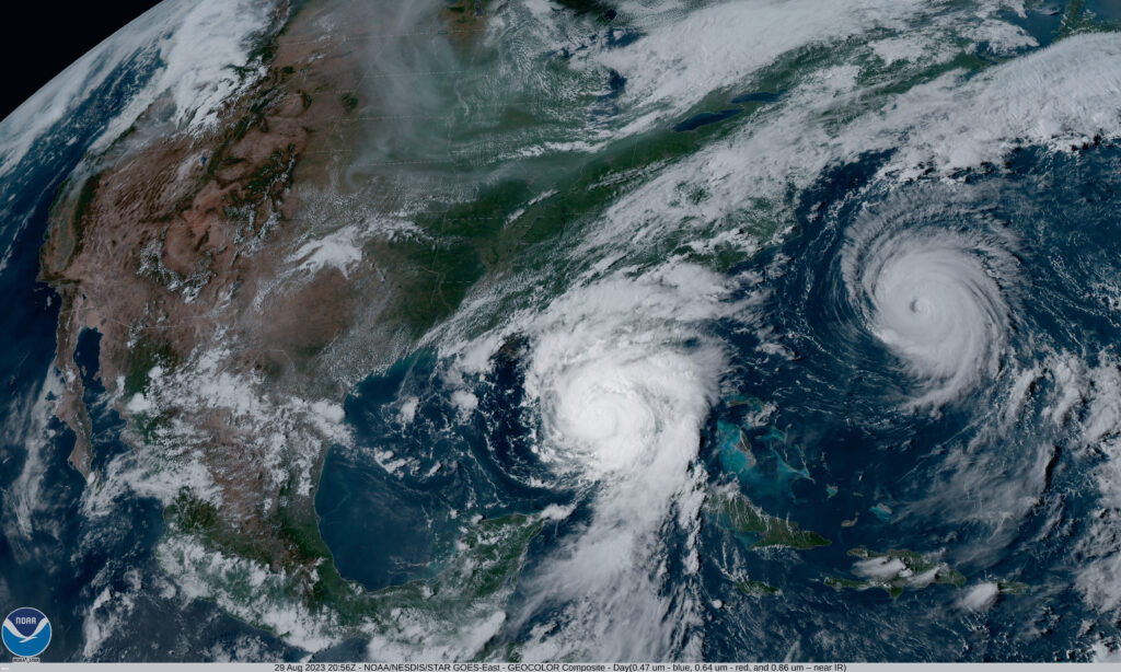
 Of course, like most hurricanes, the possible impact of Harvey was partly understood prior to landfall.
As the storm approached the American coastline, our client, a leading worldwide insurer, had three urgent priorities:
• To use Geospatial Insight’s analytics to predict and preserve the safety of company staff located in Houston
• To offer rapid assessments of potential and actual damage throughout the event to individual policyholders
• To immediately facilitate claims and provide financial relief rather than waiting on service from human assessors
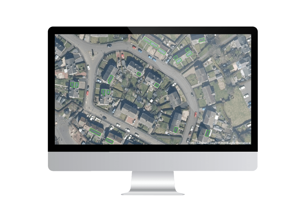
Our ability to anticipate and adapt to unique storm features is part of what makes Geospatial Insight such a powerful partner to insurers during a CAT event – both for specific properties and full regions. From geocoding policyholder data to develop baseline assessment and flight plans to ensuring logistical resilience throughout a storm’s challenges, we deliver flexible and methodical support, analysis and insight.
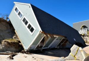
Within a week of Harvey’s landfall, critical information for individual policyholders was compiled and shared, and our overall data-gathering and analysis operations were nearing completion. Our technology, extensive partner network, and in-house operational expertise are critical to our advantage in delivering this rapid service.
“Three things that matter most in our business are speed, sophistication and service.”
Dave Fox, CEO
A new service
As a special pilot program, our client also requested access to our proprietary software portal for a small group of customers. In addition to our standard rapid response services, Geospatial Insight deployed a customer-facing portal with personal tools and full information about damage, including video footage and assessment reports.
This portal mirrors the service we offer to our clients, who rely on our swift responsiveness to capture visual evidence and provide immediate assessments of damage. Our Visual Intelligence service offers real-time insight, experienced management of operations in severe conditions and certainty as to what exactly has happened to affected properties.
By embracing our technology and taking the additional step of providing information to policyholders, our client could meaningfully prepare for the financial ramifications of Harvey and initiate prompt, caring, and knowledgeable service– well before any human assessor could even begin the work of acknowledging, verifying, and resolving claims.
A Pilot Expansion for Irma
The service was a critical source of support. Initial feedback indicated usefulness far beyond expediting the insurance claims process: for example, business customers used our analytics to adapt operational plans as the storm path evolved, provide much-needed support to employees, and develop contingency plans for various storm scenarios.
Customer service and risk management are necessary components of the claims process, and Geospatial Insight provides insurers with the opportunity to excel in both areas. Our fast, accurate, and flexible analytics offer unprecedented access to information for insurers and policyholders – turning this traditional part of the insurance business into a source of innovation in efficiency and client service.