- Bans on new petrol and diesel vehicles coming into force in 2030.
- The clear environmental benefits of switching to an electrified mode of transport.
- The potential financial savings an EV vehicle can deliver against the traditional combustion engine, particularly relevant given the ongoing energy crisis.
However, the charging infrastructure needed to meet this growing demand is not being deployed at the pace or scale required. The UK is a complex mix of rural and urban, historic and contemporary, residential and commercial, making planning a charging network a challenging proposition.
The UK government is targeting 4 million chargepoints by 2030, with an estimated spend of over £16 billion, but where these chargers will be deployed – and what type – still needs to be determined.

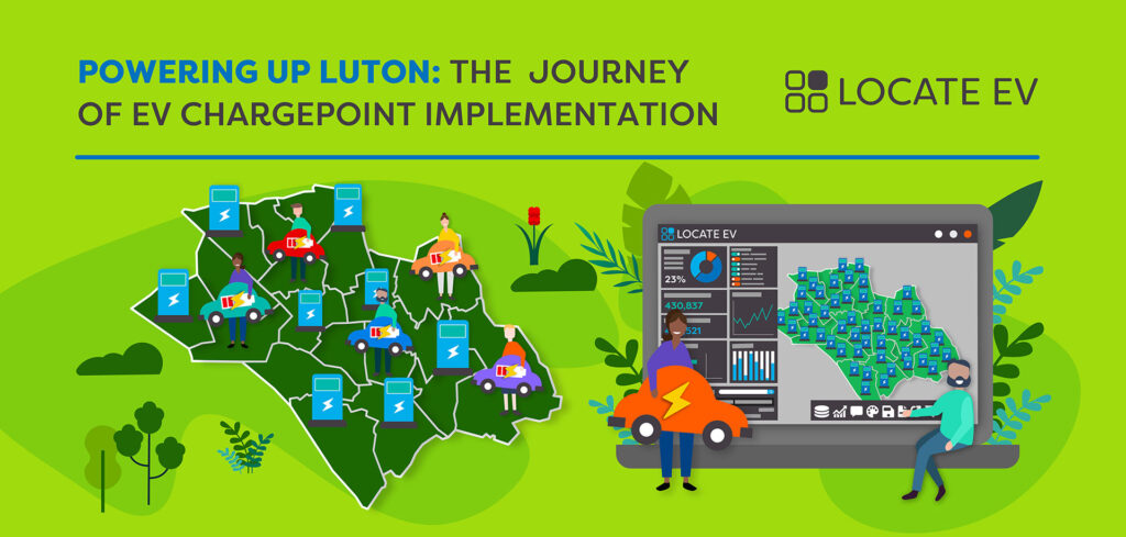
Our Client’s Needs…
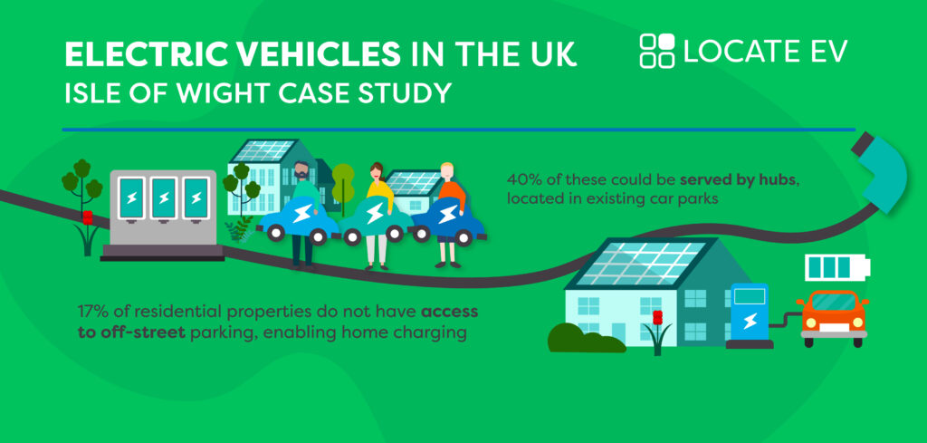
The Isle of Wight, situated off the coast of Hampshire, is the UK’s largest and second most populous island. As part of their Climate Strategy, the Council announced a need to encourage and facilitate the switch from combustion engine vehicles to EV to support the island’s wider decarbonisation goals.
The number of vehicles on the island can fluctuate dramatically during the tourist season, with vehicle ferry access from both Southampton and Portsmouth making it a popular holiday destination.
To enable the Council to develop a future-proof strategy for the deployment of EV charging infrastructure on the island, they needed a much better understanding of the current network’s status and service area, the current and future residential demand, and the potential for Council owned and operated carparks to be utilised as charging hubs.
This information would enable the Council to additionally apply for a Central Government grant to fund deployment.

Our Solution…
The Isle of Wight Council were previously identifying and assessing potential EV chargepoint installation sites via a combination of field surveys, manual map interpretation and resident requests.
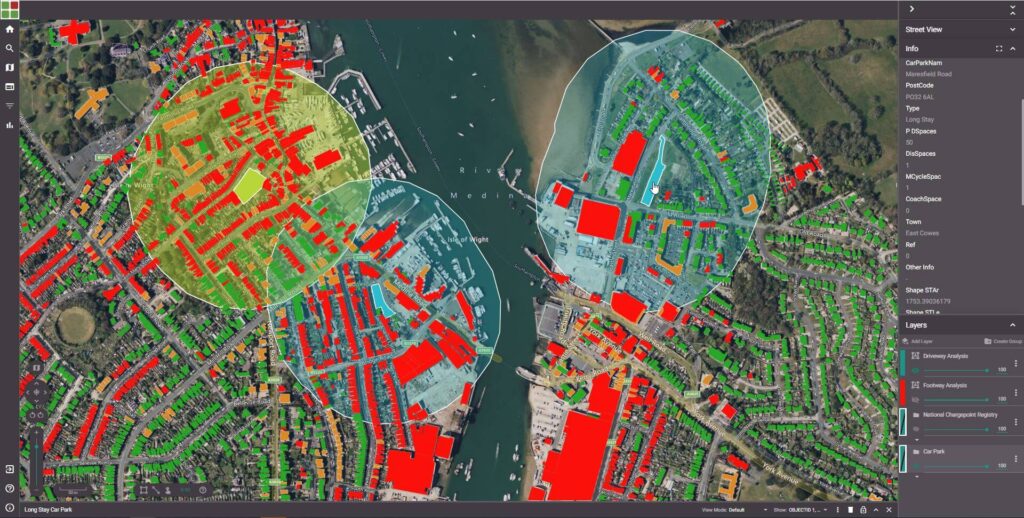
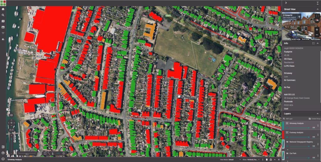
Geospatial Insight proposed a digitalised process that automated the identification of properties with a lack of off-street parking and determination of which of those properties could be served by charge points deployed in Council owned and operated car parks.Where on-street infrastructure was required, a novel methodology to calculate footway widths and identify potential constraints (bus stops, road junctions, street furniture) was implemented to determine footway sections suitable for a safe and unimpeded installation.
The outputs were delivered via Geospatial Insight’s LOCATE platform, enabling the Council to intuitively visualise and interrogate the results without the need to host or manage data or third-party software.
The Results…
Geospatial Insight’s analysis focused on the 10 largest conurbations on the island: Newport, Ryde, Cowes, Sandown, Shanklin, Freshwater, East Cowes, Ventnor, Bembridge and Wootton.
A total of 46,430 properties were assessed, of which 8,892 (17%) were identified as having no access to off-street parking. This percentage varied from as high as 30% in East Cowes to just 5% in Wootton. The average percentage of properties per town without off-street parking was 19%.
Of the 8,892 properties without off-street parking, 3,591 (8% of all properties) were within 200m of a Council owned or operated car park, 200m being the Council’s estimated maximum walking distance for a user if the car park became a charging hub. This percentage was as high as 16% of all properties in Ventnor, and as low as <1% Bembridge. The average percentage of properties per town within 200m of a car park was 8%.
Next Steps…
The Council will be collating results from the data as a core input into a funding bid to the Government’s ‘Local Electric Vehicle Infrastructure Fund’ (LEVI), which will contribute to the capital costs of physical chargepoint deployment.
Isle of Wight Council and Geospatial Insight are currently assessing the potential to extend the study to include the full island, enabling the Council to consider rural properties and residents in future planning.
Isle of Wight Council have been utilising Geospatial Insight’s LOCATE platform, to determine the most beneficial locations to deploy charging infrastructure in Council owned and operated car parks and for onstreet locations.
Once sites have been identified, the Council will rank and prioritise them based on the current and future demand, calculated from the intelligence provided on availability or lack of off-street parking.