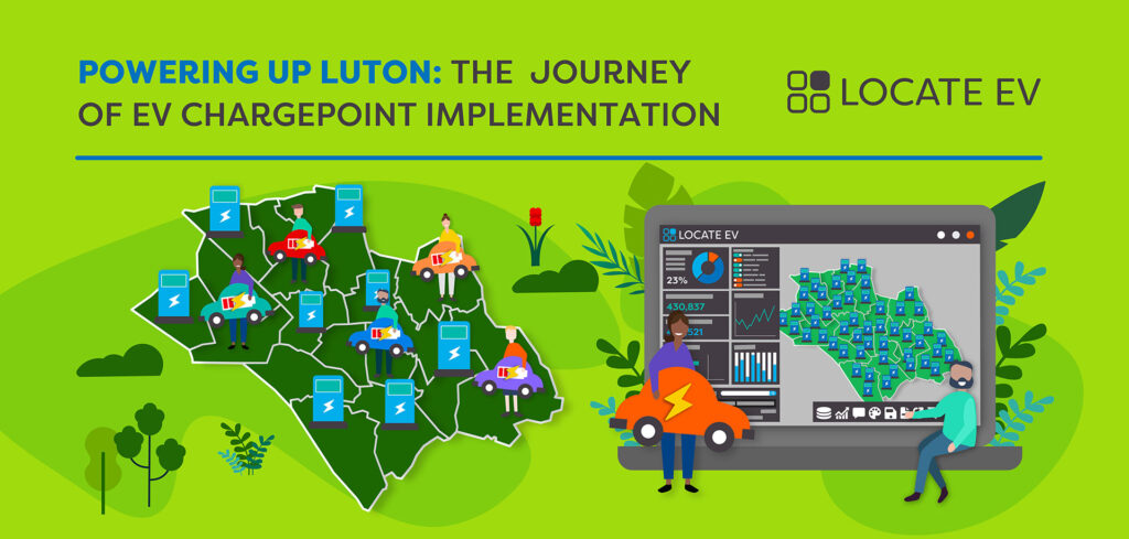
The Challenge
Luton Borough Council had been relying heavily on a combination of public requests for charging points and manual analysis of aerial and on-street imagery to identify potential sites. While this approach had yielded some success, it was far from efficient. The process was time-consuming, lacked consistency, and often failed to fully account for future demand or broader community needs.
Preparing to roll out its ambitious EV infrastructure program, they faced several key challenges:
- Identifying Suitable Sites: With the city’s diverse urban landscape, identifying suitable locations for charge points was complex. The council needed to assess a wide variety of locations, including residential streets, council-owned car parks, and busy commercial areas, to ensure broad coverage.
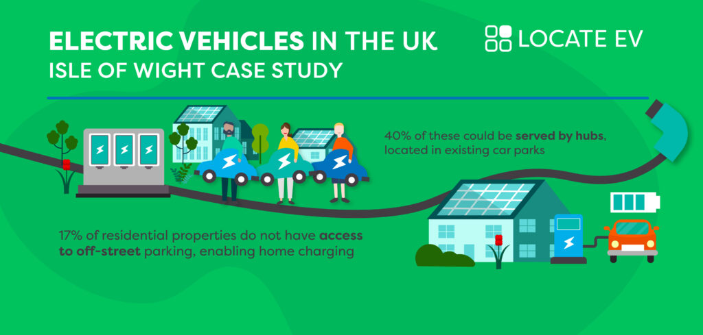
- Ensuring Equitable Access: A significant portion of the city’s population does not have access to off-street parking. The council needed a way to objectively identify and prioritise these areas to ensure that EV infrastructure would be accessible to all residents, regardless of their housing situation.
- Sensible Growth: With the substantial LEVI funding, Luton was under pressure to demonstrate that the money would be spent wisely. They needed to ensure that the rollout would not only meet current demands but also be scalable and adaptable to future needs, avoiding unnecessary or poorly located installations.
The Solution
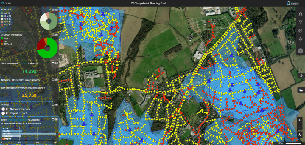
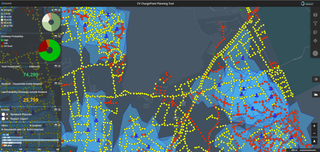
Geospatial Insight’s LOCATE EV platform provided the comprehensive, data-driven solution that Luton was seeking. LOCATE EV enabled the council to assess potential sites for EV charge points using a combination of historical and predictive data, helping them to make informed decisions based on current and future demand.
The platform allowed the council to:
- Analyse Demand: LOCATE EV provided detailed insights into areas with high current and projected demand for EV charging, particularly focusing on residents without off-street parking. This ensured that the council’s infrastructure investments would have the greatest impact.
- Evaluate Site Suitability: By incorporating a wide range of contextual data, including traffic patterns, existing infrastructure, and environmental considerations, LOCATE EV allowed the council to assess the suitability of different types of infrastructure, such as bollards or car park installations, in a virtual environment, reducing risk and enabling more precise planning.
- Monitor and Record Impact: The platform’s robust analytics capabilities enabled Luton to not only identify where charge points should be installed but also to monitor the impact of these installations over time. This data was crucial for justifying expenditure and demonstrating the effectiveness of the council’s EV strategy.
Implementation and Results
Since implementing LOCATE EV, Luton has made significant progress in its EV infrastructure deployment. The platform has proven to be an invaluable tool in the decision-making process, saving time and reducing the need for extensive on-site surveys by providing detailed site assessments online.
Luton’s commitment to a data-driven strategy is also paying dividends in terms of future planning. The council are in the process of establishing a strategic long-term program for EV infrastructure deployment, with plans extending over the next two to three years. Regular data renewals and new functionality updates provided by LOCATE EV ensure that the council can continually refine and adapt its approach, keeping pace with the rapidly evolving EV landscape.
Conclusion
Luton’s partnership with Geospatial Insight is a prime example of how local authorities can leverage data-driven solutions to make smarter, more informed decisions about public infrastructure. By using LOCATE EV, the council has not only optimised the deployment of its EV charge points but also ensured that every installation is backed by rigorous data analysis, demonstrating a clear return on investment.
This approach exemplifies a shift towards more intelligent, locally informed decision-making, where councils can take full advantage of their unique insights into their communities while benefiting from cutting-edge technology. Luton’s experience shows that with the right tools, local authorities can meet the challenge of EV infrastructure deployment head-on, delivering results that are both economically sound and environmentally beneficial.
As Luton continues to expand its EV network, the lessons learned from this data-driven approach will serve as a model for other councils across the UK, illustrating the power of combining local knowledge with advanced geospatial analytics to achieve sustainable urban mobility goals.