Ground Monitoring

Development, construction, and sustainable operations of critical infrastructure and property rely on land surface and structural stability. We deploy asset monitoring solutions leveraging satellite data and AI for constant surveillance from project initiation to operation. Through rapid, accurate detection of ground stability changes, stakeholders can make informed decisions, ensuring project success and safeguarding investments.

Solution


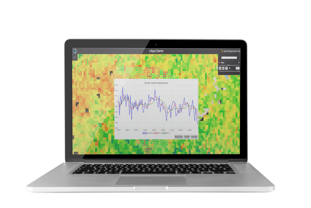
Our ground monitoring service MotionMonitor delivers consistent and precise monitoring of relative ground displacement across all landscapes. Movement that could pose a threat to infrastructure stability or lead to environmental disasters, such as landslides, is rapidly identified and visualised to highlight potential risks, enabling preventative measures to be taken.

MotionMonitor utilises APSIS (Advanced Pixel System using ISBAS), the ground-breaking Interferometric Synthetic Aperture Radar (InSAR) software, developed by the University of Nottingham & Terra Motion. APSIS delivers accurate measurements of surface height changes, uniquely, across all terrain types, including vegetated surfaces.

Dramatically outperforming other InSAR methods, in terms of data density and completeness, APSIS delivers 2-8x higher density of measurement points in urban areas and 7-15x higher density on non-rigid or vegetation-covered surfaces.

Ready to get in touch?

Benefits

Potential Failure Point Identification

Rapid detection of potential point of failure to enable pre-emptive remedial action

Contextual Risk Analysis

Unique ability to measure ground surface movement not just of an at-risk structure but of the surrounding landscape too

Holistic Failure Risk Assessment

Comprehensive evaluation of variables contributing to failure risks

Non-Intrusive Risk Monitoring

Consistent and non-disruptive surveillance to identify and analyse risks. No requirement for ground infrastructure such as corner reflectors

Download

Download the MotionMonitor Product Sheet

DOWNLOAD

Features

Ground Coverage Versatility

Comprehensive monitoring across all surface types, including vegetation

Early Warning System

Proactive detection of ground displacement for responsible asset management

Trend Analysis

Time-series examination of ground movement for risk identification

Data Integration Efficiency

Efficient integration of diverse data sources for comprehensive monitoring

Check out the Latest Insights and Updates from the Geospatial Insight Team

Learn More

Request a demo

Fill The Form Out Below And One Of Our Sales People Will Be In Touch Shortly

Interested In Buying Our Products?

Fill The Form Out Below And One Of Our Sales People Will Be In Touch Shortly