Risk Assessment

Precise portfolio/critical infrastructure risk assessment is crucial for insurers, governments, and NGOs to effectively management risk and build resiliency. Leveraging global satellite imagery and advanced data processing and AI technology, we can deliver unique insights and comprehensive understanding if the risk environment to support the planning of mitigation strategies.

Solution


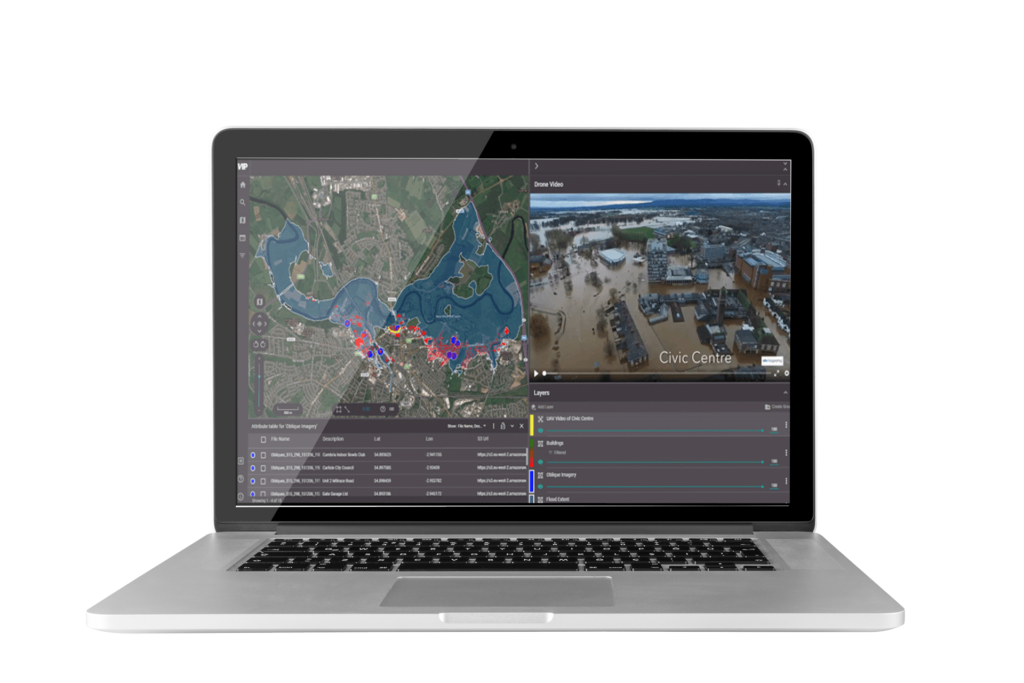
Our Risk Assessment service provides granular risk data which supports analysis of the threat posed by a range of perils to property infrastructure and communities to insurance companies, governments, and NGOs. Highly scalable solutions deliver detailed insights and enable proactive risk assessment.

Using a wide range of geospatial imagery sources and advanced AI algorithms RiskAssess enables insurers to effectively manage their customers’ portfolios and assists governments and NGOs in identifying and proactively managing risks associated with critical infrastructure such as dams and transport networks and to centres of population.

Ready to get in touch?

Benefits

Evidence Based Risk Assessment

Combining models with up to date empirical remotely derived measurement RiskAssess delivers unique understanding of exposure/asset risk status

Comprehensive Portfolio Monitoring

Continuously monitor insurance portfolios and key infrastructure and populations with geospatial surveillance for early risk detection

Proactive Risk Mitigation

Use predictive analytics and geospatial data to implement proactive risk mitigation strategies.

Efficient Resource Allocation

Optimise resource allocation by prioritising high-risk areas and efficiently deploying assessment teams

Features

Advanced Risk Analysis

Utilise high-resolution satellite imagery and AI-driven algorithms to model risk and deliver a range of threat scenarios for critical exposures and locations

Proactive Risk Mitigation

Predictive analytics delivered by RiskAssess enable the implementation of proactive risk mitigation strategies

Single Account Access

Seamlessly access data for any territory worldwide through a secure and intuitive portal

Enhanced Insights, Reduced Costs

Highly scalable and cost-effective insights

Check out the Latest Insights and Updates from the Geospatial Insight Team

Learn More

Request a demo

Fill The Form Out Below And One Of Our Sales People Will Be In Touch Shortly

Interested In Buying Our Products?

Fill The Form Out Below And One Of Our Sales People Will Be In Touch Shortly