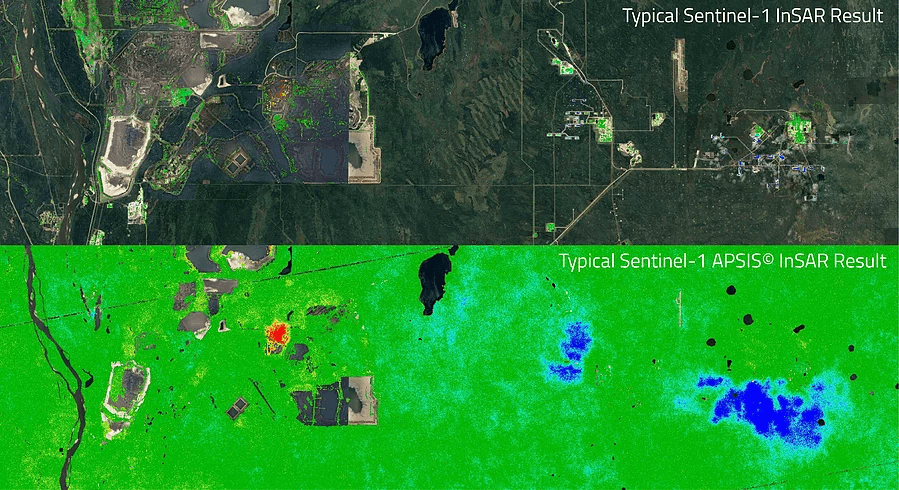
Asset Monitoring
Effective asset monitoring protects critical infrastructure through constant surveillance to identify and measure potentially damaging trends. By detecting issues early, organisations can enhance asset longevity and efficiency, reducing through life costs and prevent disastrous failure. This proactive approach supports ESG planning, enabling responsible and sustainable operations to meet regulatory guidelines.
Robust monitoring systems enable early detection of emerging trend enabling swift remedial action, minimising disruptions and environmental impact. Regular assessments and data-driven insights ensure compliance with industry standards, safeguarding assets and the local environment, building trust with key stakeholders and the community. Prioritising asset monitoring balances operational efficiency, cost management, and sustainable practices
Solutions