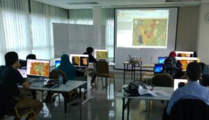
Over recent times our training sessions, which have traditionally been onsite, have, like many other activities, been postponed due to COVID restrictions. This has given our team the opportunity to evaluate our current training programmes and look at new ways to deliver the training courses as well as continue to enhance the content. Our courses have been adapted to be delivered virtually as well as onsite either at your offices or ours, offering more flexibility on how and when the training is delivered. It is therefore now feasible to offer smaller blocks of training, for example four morning sessions rather than two solid days, as these are easily delivered virtually.

To achieve greater sustainability and extend the options of tailoring courses to specific needs we have developed a new training structure. Instead of offering fixed courses, we now offer a set of modules that you link together to develop the course that best meets your needs. Our trainers work with you to truly tailor the course to the specific requirements of your team. Our modular structure for ERDAS IMAGINE training is available here. Whether it is introductory level such as familiarisation with the software and understanding the spectral characteristics of imagery or developing advanced techniques such as implementing artificial intelligence and deep learning algorithms for automated classification and semantic segmentation, or somewhere in the middle, the range of modules cover all the functionality within the software.
“INSTEAD OF OFFERING FIXED COURSES, WE NOW OFFER A SET OF MODULES THAT YOU CAN LINK TOGETHER TO DEVELOP THE COURSE THAT BEST MEETS YOUR NEEDS.”
We will also integrate your data and your workflows into the course to provide a sustainable solution. Additionally, we introduce new data sources from our ever increasing partner network to illustrate how these new resources may enhance current working practises.
Similar structures are also available for other technologies such as GeoMedia and M.App Enterprise to develop users specialised knowledge and increase their use of image processing and geospatial techniques across all aspects of their work activities.
For further information about the courses, including discounted rates for academic and research institutions registered for the Hexagon Geospatial CHEST agreement, contact us at [email protected] We look forward to hearing from you and working with you to develop your sustainable training solutions that extend beyond your current requirements to meet the demands of the future.


