Hexagon

HxGN Live global 2022 wrap up
Having recently joined Geospatial Insight, I was thrilled with the opportunity to attend Hexagon Live…

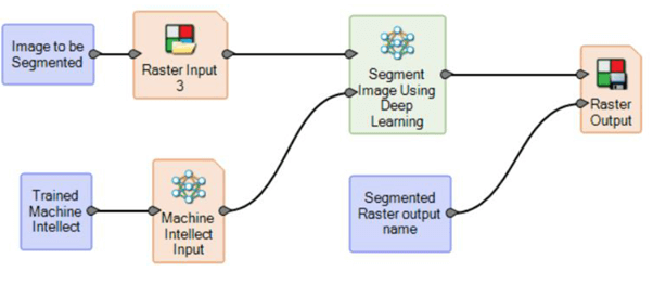
Using the User Operator in ERDAS IMAGINE
A quick tutorial video explaining how to discover the functionalities of User Operator in Spatial…

A day in the life of a Hexagon Geospatial developer
As a Platinum Partner of Hexagon Geospatial, we not only distribute their leading-edge technologies across…

How to Use Feature Process in ERDAS IMAGINE
A quick tutorial video explaining how to feature process in Hexagon Geospatial ERDAS IMAGINE software
ERDAS IMAGINE 2022 – what’s new?
ERDAS IMAGINE 2022 is now a couple of months old so it’s a good time…

How to Subset by Shapefile in ERDAS IMAGINE
A quick tutorial walking through how to clip data by a shapefile (.shp) in Hexagon…
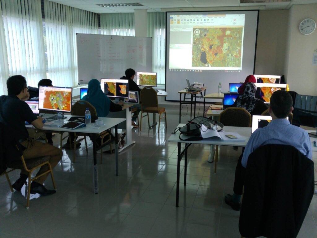
Tailored training for greater flexibility and sustainability
If you are looking for the best ERDAS IMAGINE training in the UK then you…
ERDAS IMAGINE Training Modules
Delivering ERDAS IMAGINE training courses worldwide. Discover our suite of module training packages, suitable for…
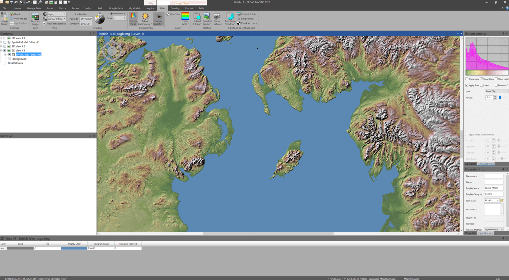
How to Use Image Chain in ERDAS IMAGINE
A quick tutorial to show you how to use Image Chain in Hexagon Geospatial’s ERDAS…

Build a Custom Button in ERDAS IMAGINE
A quick tutorial to show you how to create a custom button using the Spatial…
Enhanced CHEST bundles offering world-class solutions
The new Hexagon Geospatial CHEST Agreement for academic and research institutions in the UK and…
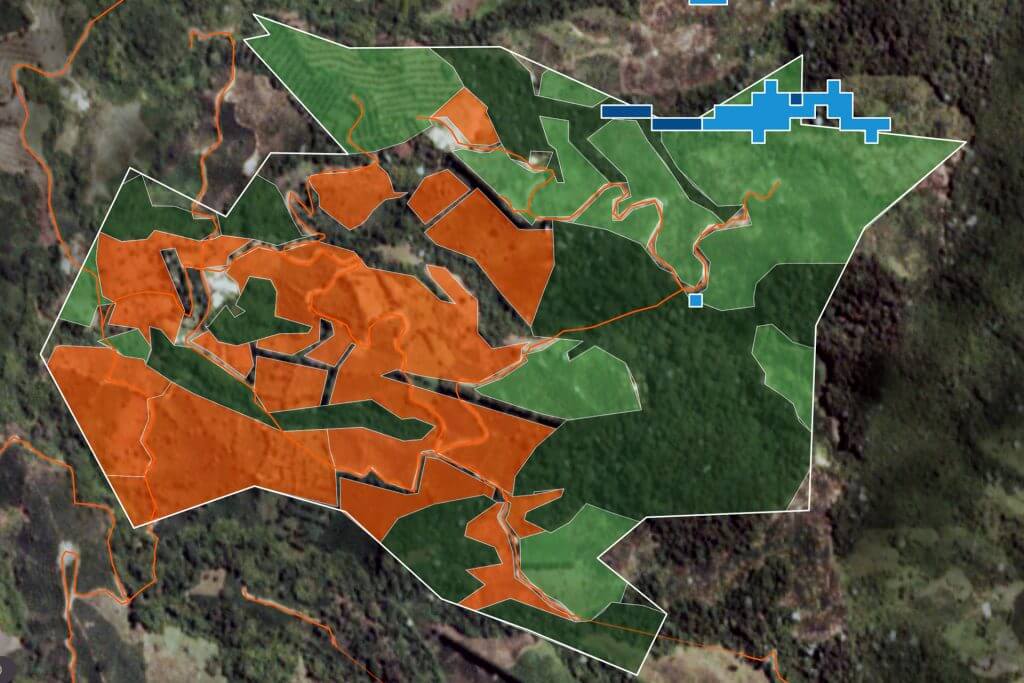
Satellite Technology Enhances Credit Lending Decisions
With over a decade’s experience in developing bespoke solutions for clients in the insurance, investment,…

Loop and Batch Run Using Iterator in ERDAS IMAGINE
A quick tutorial showing you how to loop and batch run by using the Iterator…

Automate NDVI Workflow in ERDAS IMAGINE Continued
A follow to our previous quick tutorial, showing you how to create your own directory…
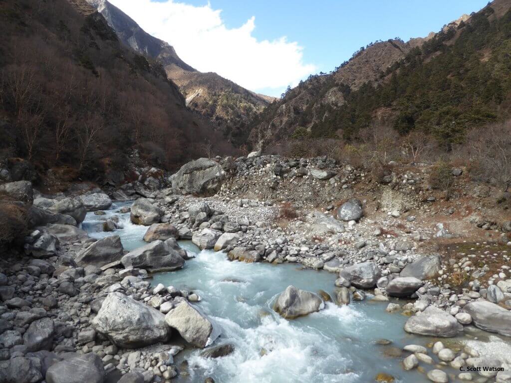
High-resolution 3D mapping in Nepal
Scientists and students at the University of Leeds use IMAGINE Photogrammetry* to generate high-resolution elevation…