Home Featured

Latest Updates to Geospatial Rooftop Solar Database Unlocks Financial Benefits
Geospatial Insight, the UK’s leading provider of clean energy geospatial solutions, announces the rollout of…
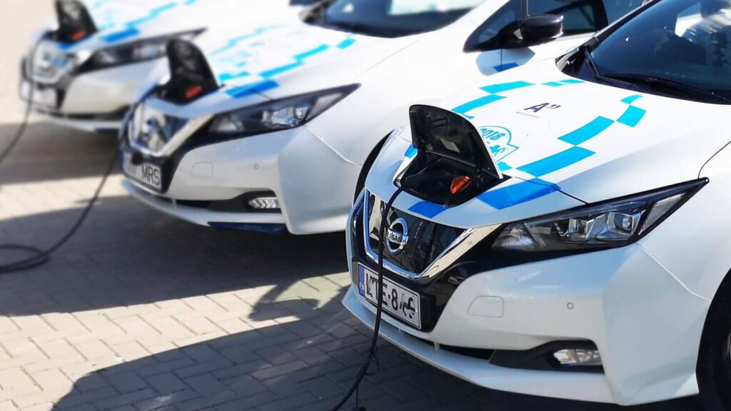
Luton’s Data-Driven Approach to Electric Vehicle Infrastructure
Luton Borough Council recently embarked on a strategic initiative to expand its Electric Vehicle (EV)…

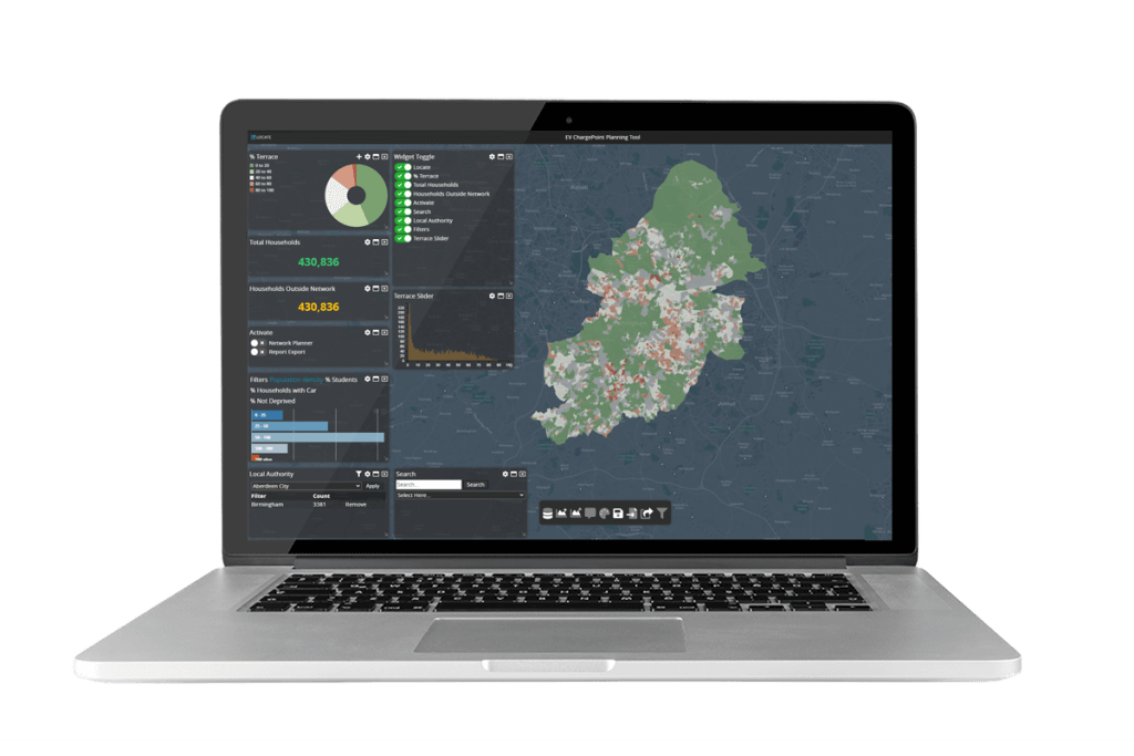
LOCATE EV 2024 Release Supports Untapped ChargePoint Opportunities
The leading EV network planning platform, LOCATE EV 2024 release, is now available. Developed by…
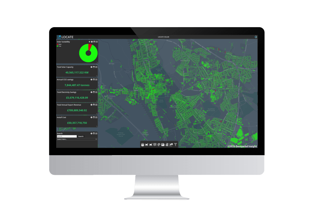
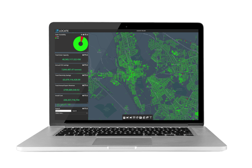
LOCATE SOLAR Database Expands to Encompass Scotland and Wales
Geospatial Insight, the UK’s leading provider of clean energy geospatial solutions behind LOCATE SOLAR, proudly…
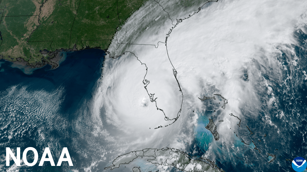
Above normal 2024 Atlantic hurricane season predicted by NOAA
The National Oceanic and Atmospheric Administration (NOAA), one of the leading scientific authorities on oceans,…

Char.gy and Geospatial Insight Forge Strategic Partnership to Revolutionise EV Infrastructure Planning
Char.gy and Geospatial Insight have officially joined forces to leverage the power of LOCATE EV,…

Market-Leading Zapmap Data Now Available on LOCATE EV, Accelerating Electric Vehicle Network Planning
Geospatial Insight, a prominent provider of clean energy geospatial solutions in the UK, and Zapmap,…
LOCATE SOLAR® Database Expands to Encompass Scotland and Wales
Geospatial Insight, the UK’s leading provider of clean energy geospatial solutions behind LOCATE SOLAR, proudly…
Geospatial Insight and Bluesky launch strategic partnership to drive Rooftop Solar uptake
With solar energy becoming a crucial component in the journey towards achieving net zero, Geospatial…
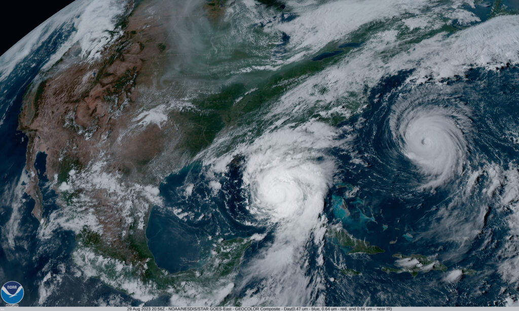
Near normal 2023 Atlantic hurricane season predicted by NOAA
National Oceanic and Atmospheric Administration (NOAA) has released their forecast for the 2023 Atlantic hurricane…

Remote Sensing Helping To Improve Wildfire Tracking
With global temperatures continually rising, and with local extremes of dry, hot weather, wildfires are…

New port decarbonisation demonstrator project launched with ESA
Geospatial Insight is leading the CACHE Net Zero (Clean Air Clean Harbour Energy for Net…

LOCATE SOLAR launch helps councils deliver on net zero strategies
Geospatial Insight, the UK’s leading provider of clean energy geospatial solutions, has launched the next…
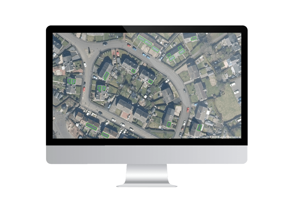
Essex County Council identifies rooftop potential using LOCATE SOLAR®
Essex County Council is responsible for over 3,600sqkm of land, 750,000 buildings and in excess…
The Latest News from Hexagon EMEA Resellers
Last month we attended the Hexagon EMEA Reseller Meeting in Mallorca – it has been…