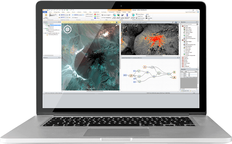
ERDAS IMAGINE provides a comprehensive image analysis suite, combining remote sensing, photogrammetry, lidar analysis, vector analysis, and radar processing into one product.
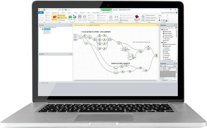
The Spatial Modeler within ERDAS IMAGINE provides the power to create versatile workflows and automated processes from a suite of intuitive graphical tools. This is an extremely effective way to process and analyse raster data.
ERDAS IMAGINE is for…
…the effective extraction of actionable information from raw geospatial data. It is the most powerful image processing package for derived information. It supports over 190 image formats and includes hundreds of functions, algorithms and analytical routines including machine learning algorithms.
Benefits of ERDAS IMAGINE
Comprehensive
The ribbon interface allows all levels of user to fully utilise the entirety of the powerful data processing capabilities of the software.
Efficient
The Spatial Modeler allows the easy creation, modification and visualisation of complex processing chains.
Powerful
The system has the power to drive geospatial workflows by utilising GPU, multi-core and distributed processing, along with a comprehensive batch processing capability.
Find out more
ERDAS IMAGINE is part of the Hexagon Power Portfolio, world leading technologies that combine the best in photogrammetry, remote sensing, GIS and cartography.
Find the ERDAS IMAGINE add on modules here or if you are more interested in a cloud-based solution? Discover M.App Enterprise