Home Featured

E Mobility
Char.gy and Geospatial Insight Forge Strategic Partnership to Revolutionise EV Infrastructure Planning
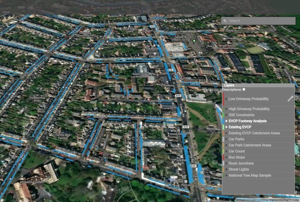
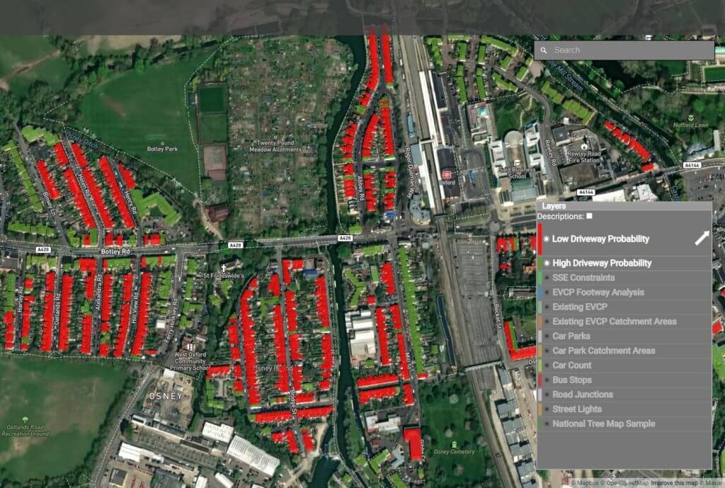
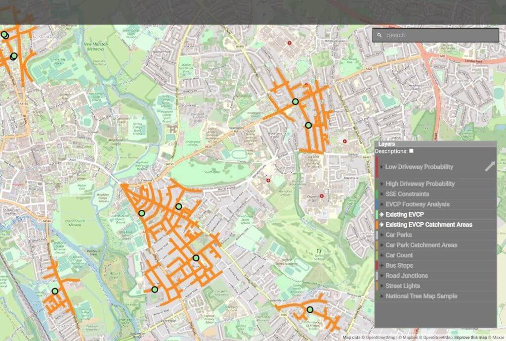
Char.gy and Geospatial Insight have officially joined forces to leverage the power of LOCATE EV, the National EV Infrastructure Planning Platform.

E Mobility
Market-Leading Zapmap Data Now Available on LOCATE EV, Accelerating Electric Vehicle Network Planning
Geospatial Insight, a prominent provider of clean energy geospatial solutions in the UK, and Zapmap, the UK’s leading charge point mapping service, have launched a new strategic collaboration. The partnership includes the integration of Zapmap data into LOCATE EV, the National Electric Vehicle Network Planning Platform.