Harnessing the power of geospatial data and advanced machine learning techniques to support a future built around sustainable energy solutions.
The devastating effects of climate change can be seen across the globe; with shrinking glaciers, rising sea levels and soaring temperatures – what was once a far-off prediction is becoming today’s reality.
At Geospatial Insight we have been developing our sustainability portfolio for the insurance market over recent years, including our worldwide disaster response service. In addition, and supported by the European Space Agency and UK Space Agency, we have invested heavily in developing a range of sustainable energy, carbon offset and emission detection and monitoring solutions to meet the growing needs ofour customers.
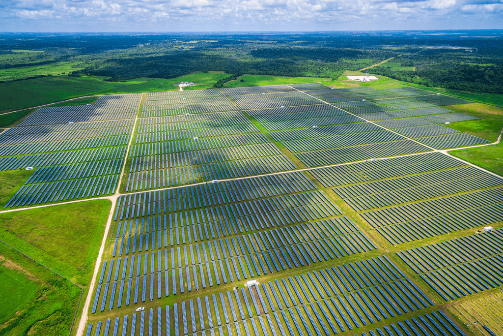
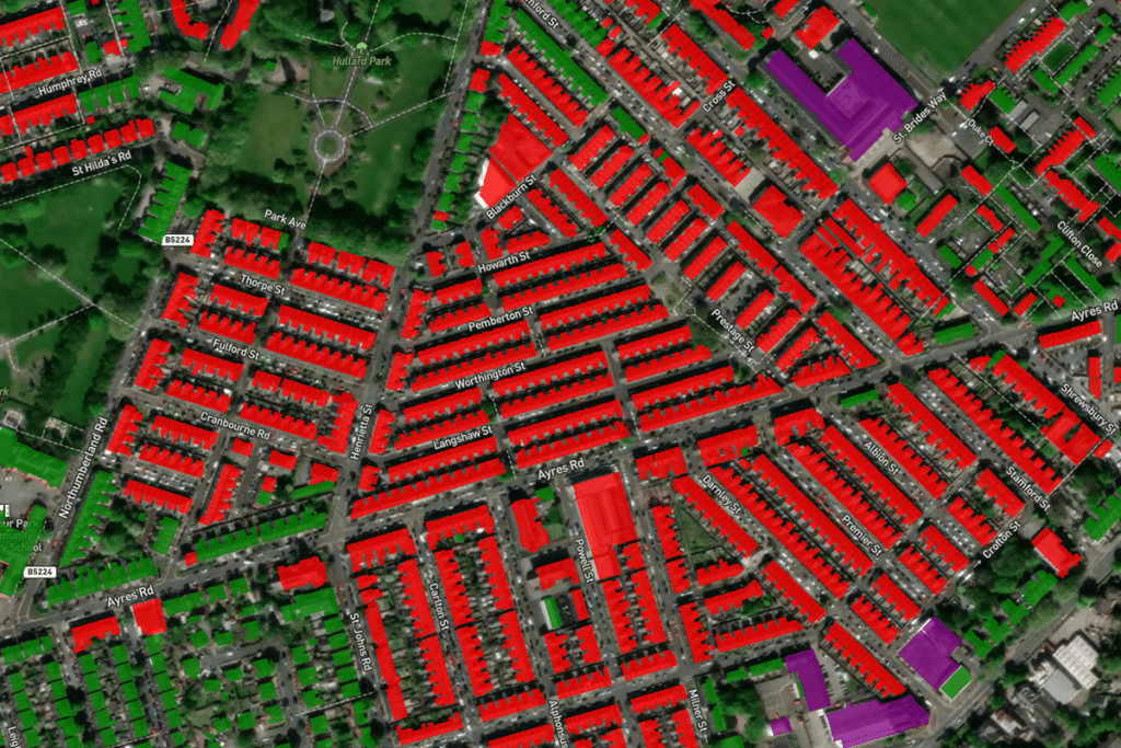
EV Charging Driveway Analysis, Trafford.
With many countries having pledged to meet carbon net zero by 2050, an important step to achieving this is the widescale adoption of low carbon technologies and energy efficiency measures, but stakeholders across the globe are being held back by a lack of relevant, affordable and verifiable data.
Taking this issue head on, we are streamlining and simplifying the process of seeking out decarbonisation and offsetting opportunities. From facilitating project aggravation to accelerating deployment, our intelligence assists with Renewable and Sustainable Energy Solutions, Sustainable Urban Mobility and Smart Grids.
Emissions of greenhouses gases are the key drivers of climate change and identifying, understanding and monitoring the sources of these emissions is a critical factor in creating actionable reduction strategies.
As well as direct detection and monitoring of methane emissions from space, this capability also encompasses the ability to identify the sources and components of air pollution, monitor patterns and trends that may be affecting air quality levels and tracking the impact of actions and strategies aiming to improve air quality.
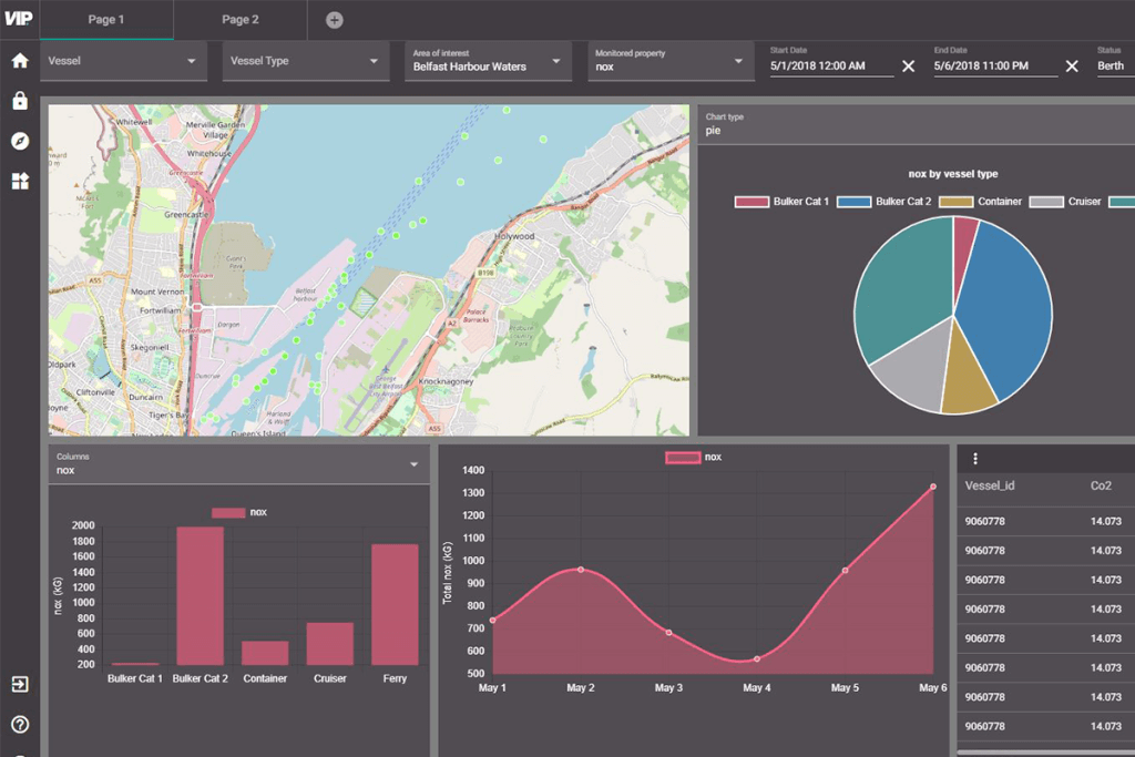
Clean Air Clean Harbour Energy Dashboard
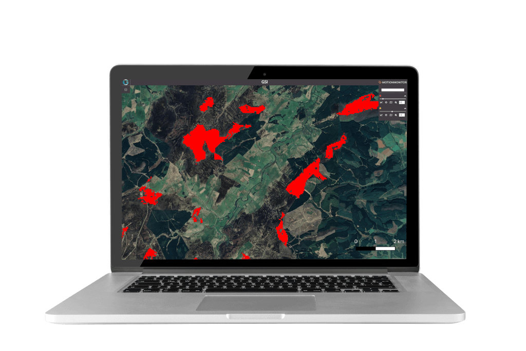
Peatland Carbon Potential Heat Map Analysis
Peatlands in particular play a crucial role in containing greenhouse gases, emitting CO2 when they are poorly managed but sequestering when they are restored. Acting as huge carbon sinks, their restoration not only has the potential to reverse their environmental impacts but to become valuable assets to create offsets for carbon trading.
Working with our partner, Terra Motion, we can use space-based techniques to measure historic surface movement of peatlands to first identify those sites with the greatest restoration potential and then provide essential, evidence-based, Monitoring, Reporting & Verification (MRV) services thereafter to quantify changes in peatland condition and support the realisation of carbon credits.
Browse our latest news and insights
Learn more about the experts behind the insights
Get in touch with our team today