In an increasingly virtual world, it is no surprise that the advancement of stereo visualisation is developing at an unprecedented rate.
Within the geospatial community, stereo visualisation is critical in understanding depth, height, and other detailed measurements with enhanced accuracy. Allowing analysts to extract as much information as possible and enabling them to create products such as digital terrain and surface models.
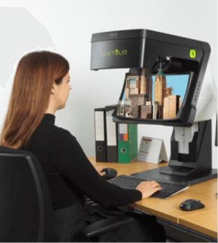
Undoubtedly, Vision Engineering is leading the way with stereo visualisation technology, with their world-class CONTOUR and VECTOUR screens.
Unlike other products, CONTOUR provides users with a glasses-free means to view data in stereo. Offering impeccable depth perception at a very high resolution, the CONTOUR design provides edge-to-edge sharpness and optimises depth, quality, and ergonomics.
CONTOUR works by projecting two independent optical channels to the users’ eyes. The result is that each eye views the geospatial data from a slightly different angle. This method replicates our natural stereo vision and perception of depth. Consequently, the CONTOUR can provide an extremely accurate output without the need for polarised glasses, making it truly unique.
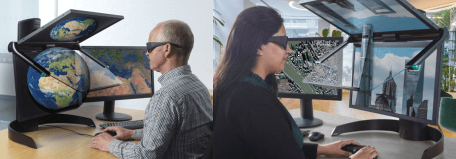
The latest addition to the Vision Engineering portfolio is the VECTOUR screen. Similar to the CONTOUR, this product hosts a range of benefits and has been designed to deliver detailed output and manufactured with user-centred ergonomics in mind, making it usable for extended periods.
The design of the VECTOUR consists of two polarised LCD monitors, which are precisely orientated, as well as a beam splitter mirror that bisects the angle between the two monitors. Using crossed-polarising glasses, the data is presented to the user by displaying a separate image to each eye. By projecting the same image into the right and left eyes, each from a slightly different perspective, the user can view the data with a precise three-dimensional effect.
Geospatial professionals worldwide continuously seek to enhance how they visualise, interact, and utilise geospatial data. The CONTOUR and VECTOUR screens are advancing visualisation significantly, as their unparalleled clarity allows analysts to extract information proficiently and precisely from base data layers.
Ordnance Survey of Northern Ireland (OSNI), part of Land and Property Services, is the official mapping agency of Northern Ireland. Due to the long history of mapping in Ireland, OSNI’s mapping data is amongst the most detailed and comprehensive in the world. To ensure these high standards are maintained, it is fundamental that their data collection techniques take advantage of the most accurate survey methods.
CONTOUR is used during the creation of national geospatial datasets and is particularly advantageous when monitoring land use changes. It is also used to ensure exceptional accuracy when creating digital terrain and digital surface models. By using CONTOUR to extract information from their own remotely sensed aerial imagery, OSNI is able to achieve the high standard of data quality for which it is renowned.
OSNI Fusion is their topographic map data. It is a seamless, polygonised dataset with a more intuitive structure that provides data in layers based on real-world features. It also contains life cycle information and unique identifiers for each feature, which can be used to link other datasets to the mapping. OSNI Fusion is updated by topographic field survey as well as photogrammetric methods.
“Stereo photogrammetry utilises the 3D vision contour screens to allow us to produce accurate topographic mapping. The contour screens have been easy to set up and use and provide an enhanced view of our high-resolution aerial imagery.” – Christine Armour, OSNI
– Christine Armour, OSNI
With impressive real-world applications such as this, it is clear that as the need to maximise the potential of geospatial data intensifies, the use of stereoscopic visualisation tools, such as CONTOUR and VECTOUR will continue to grow.