BlackSky have been continually developing and growing their optical small sat constellation since 2014. Currently with 6 satellites in commercial operation, the plan is for the constellation to grow to 14 satellites in orbit by the end of the year. Currently, the satellites generate 0.85 – 1-metre resolution imagery, but 0.5 metre resolution imagery will be available in the near future too, with plans to create a constellation of 30 smallsats. The size of the constellation, combined with a mix of orbit geometries already means that a single location can potentially be imaged multiple times a day, a capability that will be enhanced every time a new satellite is added to the constellation. This exceptional revisit time alone makes BlackSky an exciting partner to work with, opening up new opportunities for monitoring services.
The truly revolutionary component of the BlackSky service however is the ease with which new images can be tasked – and the cost of doing so. Geospatial Insight can now task the satellites directly using BlackSky’s Spectra cloud-based tasking platform. This essentially provides an on-demand imagery collection service where new images can be tasked, collected and delivered within a few hours. Reducing the number of humans, and organisation, in the process, this not only dramatically speeds up the whole tasking process, but makes it much more secure too. Additionally, and importantly, individual, small areas can be targeted for collection, reducing the cost of tasking high resolution imagery almost ten-fold compared to alternatives and allowing us to provide our clients with precise and rapid intelligence at a very affordable price.
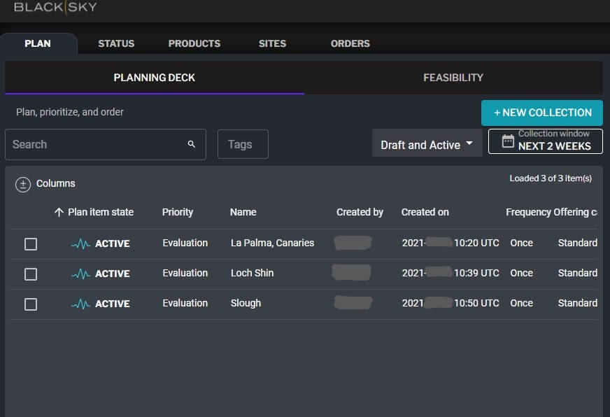
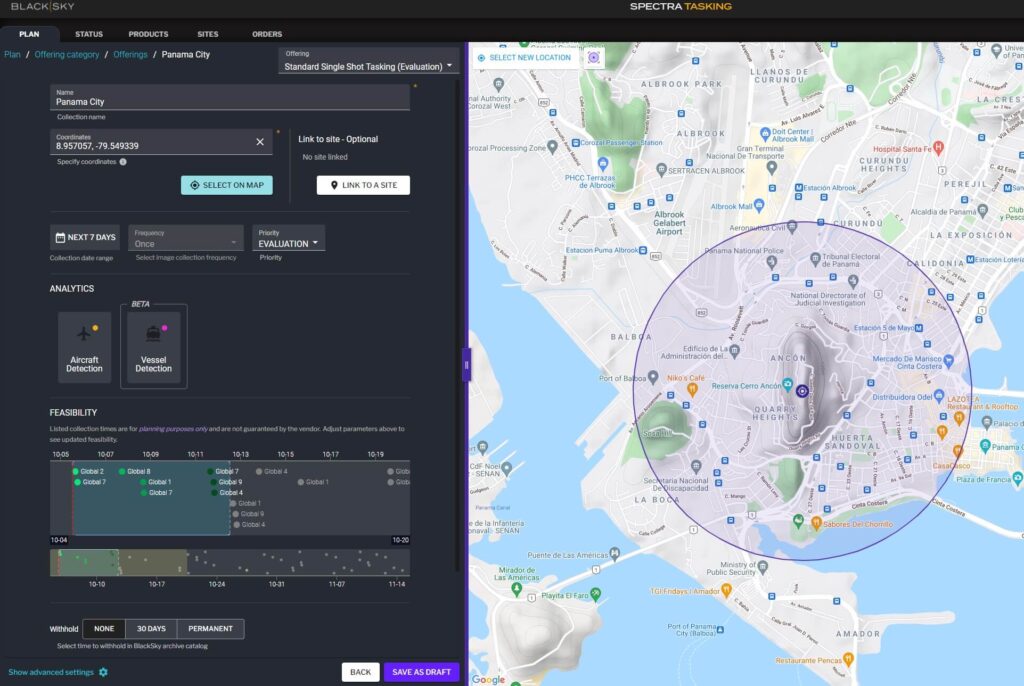
BlackSky’s Spectra cloud-based taking platform
At Geospatial Insight, we fuse our unparalleled access to world-wide imagery with leading edge, ML-based data analytics to provide a truly global service in risk intelligence. Access to the flexible image collection capabilities offered by BlackSky will augment many of our existing operational products and solutions. In particular, our (RE)ACT service delivers immediate post-disaster event analysis to the insurance sector to support loss estimation, reserving and claims assessment and the rapid acquisition of high quality imagery is often a key component of this process. Automated damage assessment algorithms can deliver an initial property-by-property damage estimate within just a few hours of receipt of the source imagery, and the streamlined acquisition and delivery flowline provided by BlackSky complements this perfectly.
Combining our proven AI-based image analysis capabilities with BlackSky’s revolutionary ability to task, target, acquire and deliver high resolution imagery offers a new level of flexibility and reactivity in the provision of on-demand intelligence. Together our partnership provides a powerful team to deliver near real-time analytics and lead the way for on-demand, affordable image intelligence.