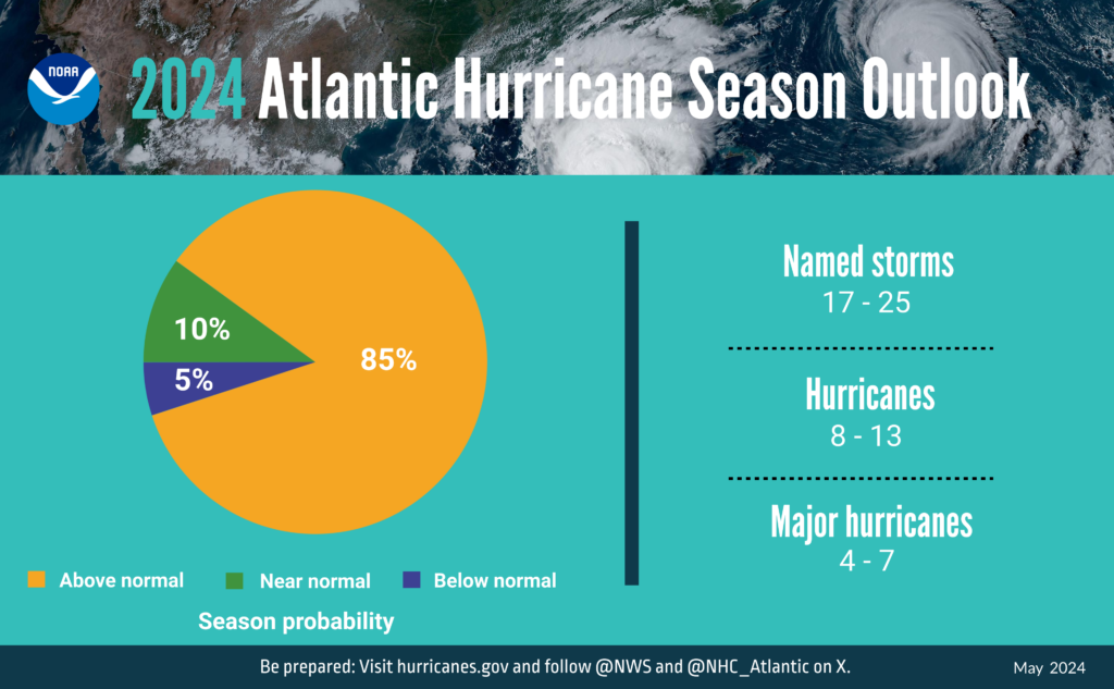
The Atlantic hurricane season spans six months, from June 1 to November 30. NOAA has forecasted an “above normal” 2024 season, with predicted numbers exceeding 2023’s record-setting events. They anticipate 17 to 25 named storms (winds of 39 mph or higher), with 8 to 13 potentially becoming hurricanes (winds of 74 mph or higher), including 4 to 7 major hurricanes (category 3, 4, or 5, with winds of 111 mph or higher).
This forecast is due to a likely shift from El Niño to La Niña, creating wind shear conditions favorable for hurricanes. Additionally, record warm sea surface temperatures in the eastern and central Atlantic could enhance the conditions for hurricane formation and intensification.
Another contributing factor to 2024’s high numbers is the potential for a above normal west African monsoon (a wind system). The resulting waves have the potential to feed into hurricanes increasing their strength and longevity. Coupled with rising sea levels caused by human induced climate change this also leads to an increased likelihood of storm surge.
Colorado State University’s Atlantic Hurricane predictions also leaned towards an above normal Atlantic season of 23 tropical storms, 11 of which are expected to become hurricanes. An almost 50% increase in the number of expected hurricanes from last year (6).
For comparison in May 2023 NOAA predicted there would be 12 – 17 named storms, 5 – 9 of which could become hurricanes. Later in August they upgraded their prediction from “near normal” to “above normal” on account of record warm sea surface temperatures. The number of predicted named storms rose to 14 – 21 and the prediction for those that would become hurricanes increased to 6 – 11. In total there were 20 named storms, 7 of which intensified to become hurricanes, aligning with the activity predicted by NOAA.
Matthew Rosencrans the lead hurricane forecaster at NOAA’s Climate Prediction Center had said “The Atlantic basin produced the most named storms of any El Nino influenced year in the modern record,”. The 2023 Atlantic hurricane season was ranked 4th for the highest amount of named storms since 1950.
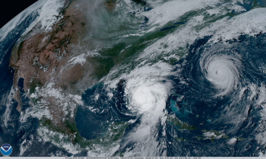
However, despite this, only one hurricane made landfall in the U.S. Hurricane Idalia, a category 3 hurricane made landfall on August 30th causing major flooding in Florida and the southeast. Canada was also struck, on September 16th hurricane Lee made landfall in Nova Scotia Canada and left large parts of Maine without power.
NOAA’s outlook is for overall seasonal activity and does not necessarily predict hurricane/storm landfall.

Regardless NOAA is already enhancing its weather and communications systems for 2024. “With another active hurricane season approaching, NOAA’s commitment to keeping every American informed with life-saving information is unwavering,” said NOAA Administrator Rick Spinrad, Ph.D.
The National Hurricane Centre will be expanding the number of products and messages that are released in Spanish and will now also release updates and warnings at more regular intervals (if needed). Traditionally public notifications happen every 6 hours.
Two new forecast models will also be put into operation, the first will highlight the intrinsic role the ocean plays in hurricane intensity and the second will predict the probability of rapid cyclone intensification. Many more improvements will be put in place to help aid forecasting and public safety.
To provide the crucial data that fuels NOAA’s increasingly accurate weather forecasts, manned aircraft are flown into the eye of active hurricanes. NOAA’s Hurricane Hunter Aircrafts (dubbed “Kermit” and “Miss piggy”) repeatedly penetrate hurricane walls to find the eye of the storm and deploy numerous instruments that continuously transmit pressure, humidity, temperature, wind direction and speed.
In 2023, NOAA Hurricane Hunter aircrafts flew 468 mission hours to collect atmospheric data that is critical to hurricane forecasting and research, passing through the eye of a hurricane 120 times and deploying over 1,400 scientific instruments.
“Severe weather and emergencies can happen at any moment, which is why individuals and communities need to be prepared today,” said FEMA Deputy Administrator Erik A. Hooks.
To help our insurance clients respond swiftly to any damaging storm, our on-demand CAT response service, (RE)ACT, is available 24/7/365. Leveraging AI-based analytics and imagery from over 750 satellites, along with a unique network of drone and aerial operators on every continent, (RE)ACT delivers rapid and precise per-property damage assessments within hours of a storm’s impact.
For more information or to request a demo, visit the (RE)ACT product page to ensure you are fully prepared for the upcoming season.