Home Featured
LOCATE SOLAR Database Expands to Encompass Scotland and Wales
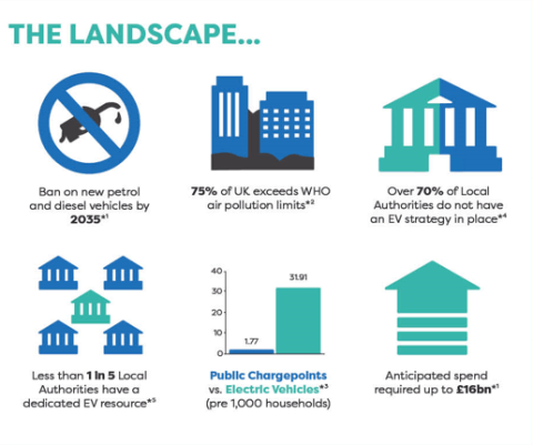
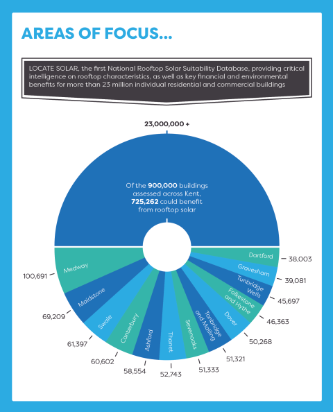
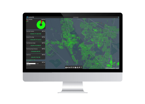
Geospatial Insight, the UK’s leading provider of clean energy geospatial solutions behind LOCATE SOLAR, proudly announces the expansion of its ground-breaking database to include Scotland and Wales. This strategic move solidifies LOCATE SOLAR as the most comprehensive and up-to-date national rooftop solar sustainability database across Great Britain.