MEASURING GROUND DISPLACEMENT FROM SPACE

Uniquely able to operate across all landscape types, MotionMonitor provides regular, highly accurate measurement of relative changes in ground displacement. Movement that could pose a threat to infrastructure stability or lead to environmental disasters, such as landslides, is rapidly identified and visualised to highlight potential risks, enabling preventative measures to be taken.

MotionMonitor utilises APSIS (Advanced Pixel System using ISBAS), the ground-breaking  Interferometric Synthetic Aperture Radar (InSAR) software, developed by the University of Nottingham & Terra Motion. APSIS enables the detection of new surface deformation zones, potential risk mapping, landslide trend change detection analysis, and historical data analysis for enhanced insights, all of which can be visualised, analysed and reported through the MotionMonitor platform.

APSIS delivers accurate measurements of surface height changes across all terrain types, uniquely including vegetated surfaces. Dramatically outperforming other InSAR methods, APSIS delivers 2-8x higher density of measurement points in urban areas and 7-15x higher density on non-rigid or vegetation-covered surfaces. This unique data coverage allows comprehensive analysis of ground displacement over time and offers millimetric accuracy using free data sources including Sentinel-1.

MotionMonitor enables professionals in the fields of geotechnical engineering, energy, environmental planning, and mining to achieve cost-effective outcomes through data-driven solutions that support sustainable development and mitigate environmental harm.


With the ability to measure variations in ground surface height across all terrains, MotionMonitor enables users to confidently tackle complex challenges through a comprehensive problem-solving approach and make informed, long-term decisions for a greener future.

MOTIONMONITOR FEATURES

  • Uniquely works over all ground surface types, including vegetation
  • Early warning system of ground displacement for responsible asset management
  • Time series analysis of ground movement trends to enable risk identification
  • Efficient integration of complementary data sources
  • Share insights and allow secure access across organisation
  • Review individual locations or complete portfolio analysis
  • Timely identification of potential stress points
  • Change analysis of the surrounding area to predict potential risk
  • Provides a comprehensive view of failure risk variables
  • Regular non-intrusive monitoring to identify & analyse risk
  • Accurate surface monitoring over all land surface types
  • No need for ground sensors or infrastructure installation
  • Integrates multiple data sources within a single platform

Boddington Mine, Australia

Related INSIGHTS

News

Decreasing the growing risk of tailing dam failures

The safety issues surrounding tailings dams has been a hot topic over the past few years, with numerous failings causing catastrophic property and environmental damages. To minimise the occurrence of disastrous collapses in the future, there is a pressing need to understand the stability of these infrastructures and implement more efficient monitoring solutions.

Read More »
News

The future of dam safety

After the collapse of Brumadinho Dam, the mining industry has been under intense scrutiny. Although the safety and infrastructure stability of tailings dams has always been extremely important, now, with the world watching, it is more crucial than ever that dam monitoring programmes are put in place.

Read More »
MotionMonitor

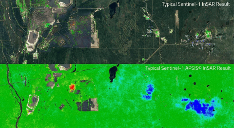
APSIS – The full coverage INSAR

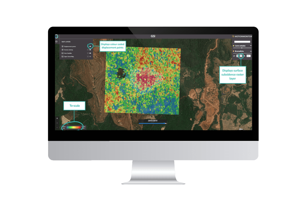
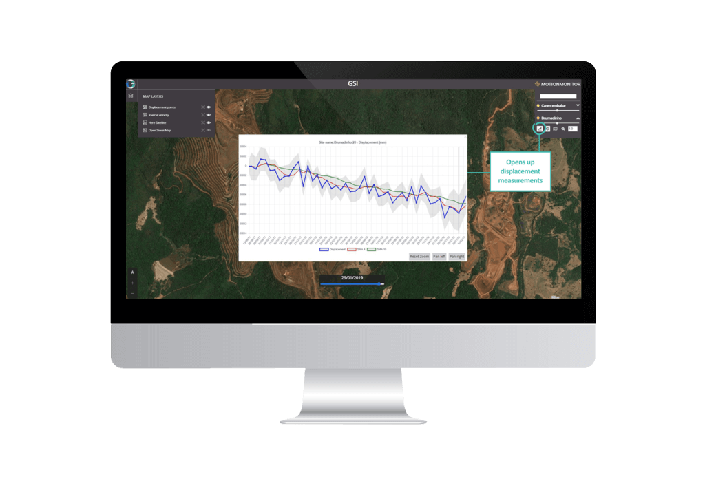
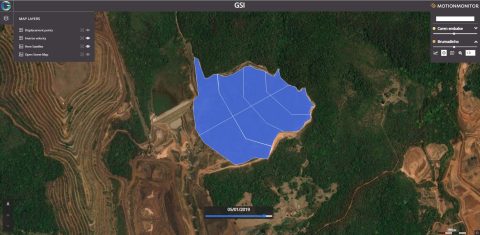
MotionMonitor, our latest service specifically designed to monitor ground movements in and around mine tailing dams, enables Tailing Storage Facility (TSF) managers and ESG compliance officers to monitor key TSF locations and provides an early warning of potential failure, therefore minimising financial and environmental impact as a direct consequence.

Read More »