Case Studies
Luton’s Data-Driven Approach to Electric Vehicle Infrastructure
Luton Borough Council recently embarked on a strategic initiative to expand its Electric Vehicle (EV)…
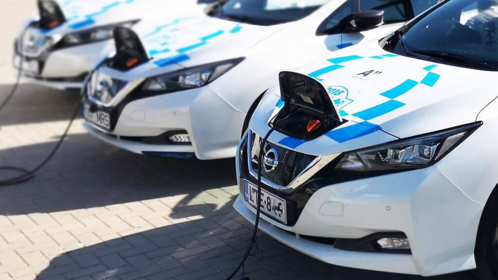
Supporting HGV Electrification in Luxembourg
Cenex, a specialised consultancy in low carbon mobility based in Leicester, has recently chosen Geospatial…
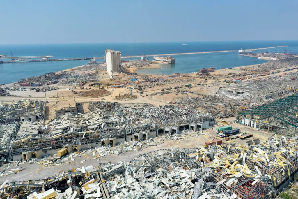
Beirut Explosion
On August 4th 2020 a vast mushroom cloud hung over the city of Beirut, created…
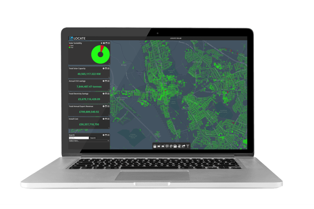
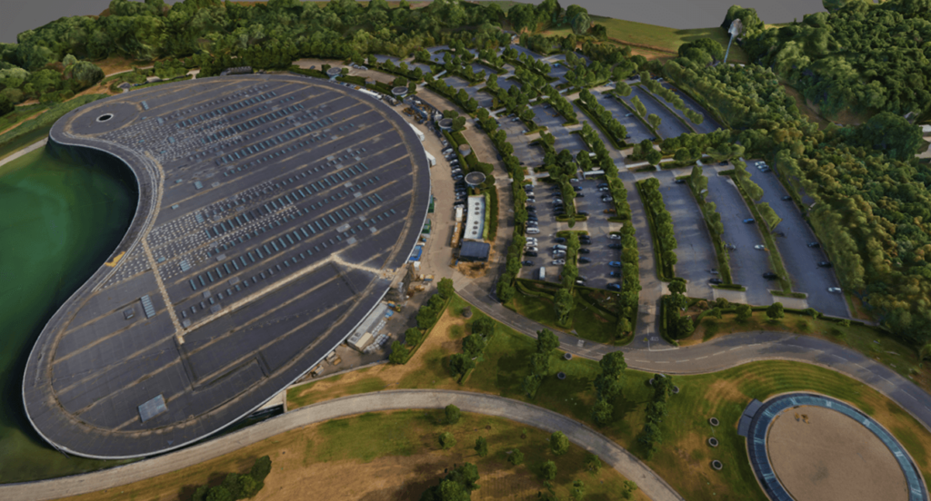
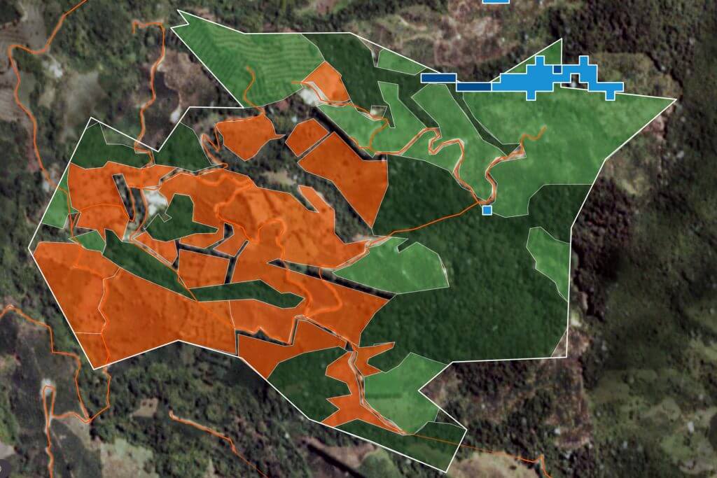
Essex County Council identifies rooftop potential using LOCATE SOLAR®
Essex County Council is responsible for over 3,600sqkm of land, 750,000 buildings and in excess…
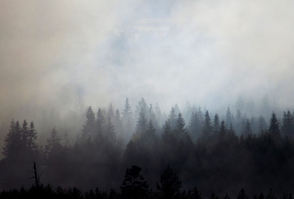
Using ERDAS Imagine to detect wildfires
Greenland is not traditionally thought of as a wildfire-prone region, however the number and size…
The Third Dimension – 3D Showcase
With an ever-increasing need for timely data and geographical understanding, governments and businesses worldwide continue…
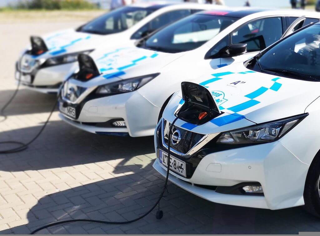
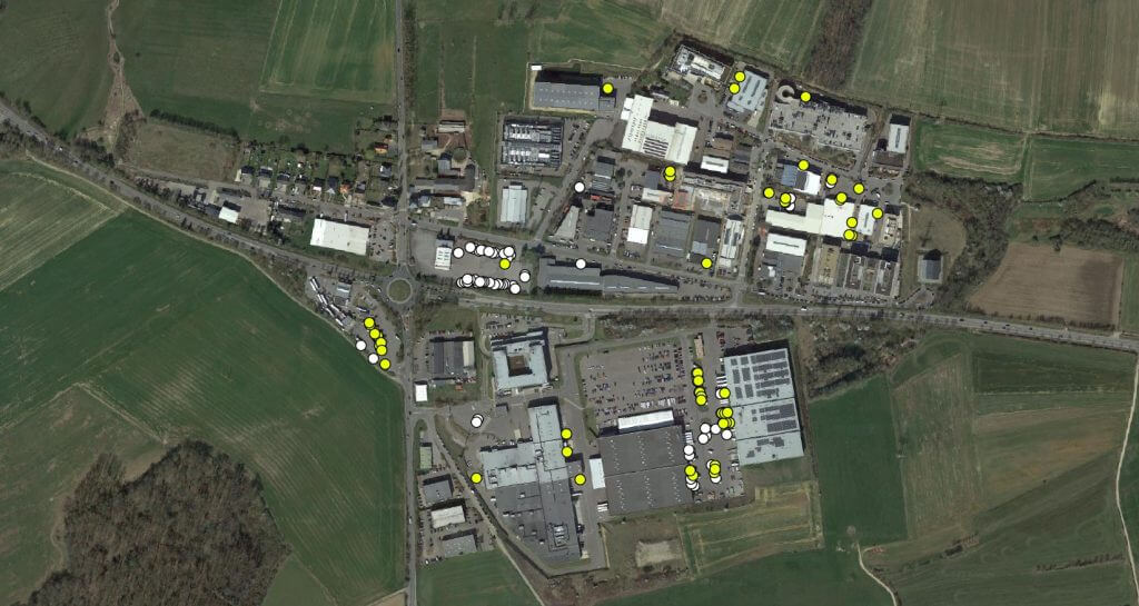
Isle of Wight EV Charging Strategy
The utilisation of Electric Vehicles (EV) in the UK has grown rapidly in recent years.…
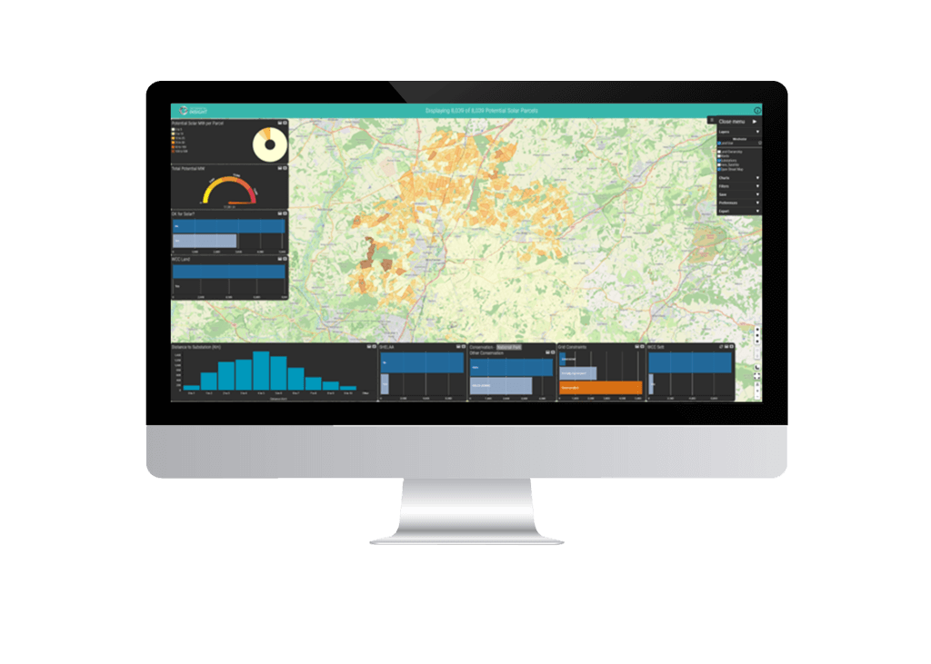
Leveraging geospatial analytics to accelerate the transition to Net Zero
Geospatial Insight partnered with Winchester City Council to transform their approach to renewable energy projects…
Satellite Technology Enhances Credit Lending Decisions
With over a decade’s experience in developing bespoke solutions for clients in the insurance, investment,…
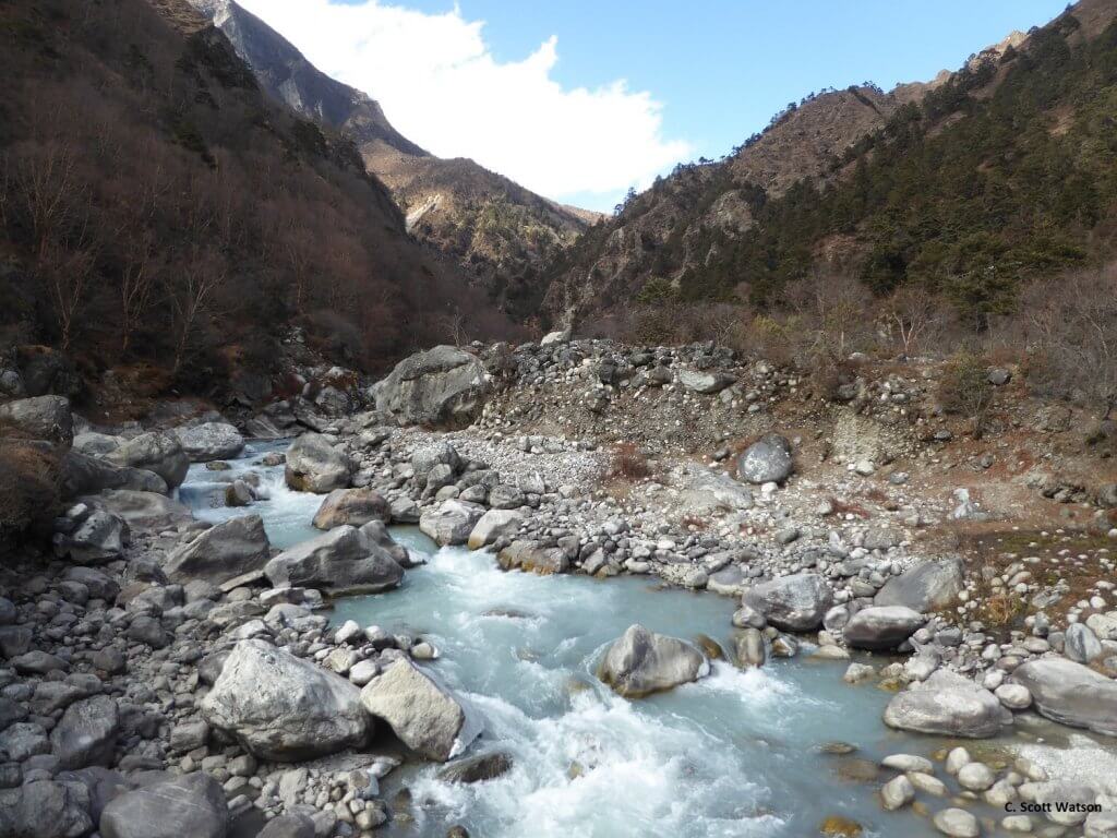
High-resolution 3D mapping in Nepal
Scientists and students at the University of Leeds use IMAGINE Photogrammetry* to generate high-resolution elevation…

Monitoring African elephants for conservation
A ‘Research in Education’ case study, documenting a recent investigation from one of our academic…
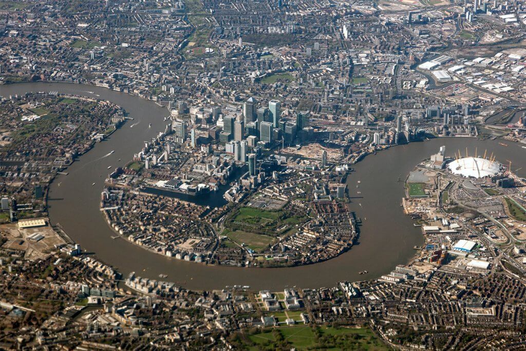
Remote sensing of London’s urban heat island
A ‘Research in Education’ case study, documenting a recent investigation from one of our academic…
Mid-West USA floods
Following the destruction brought by the recent extensive flooding in Nebraska and Iowa in the…
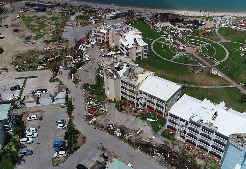
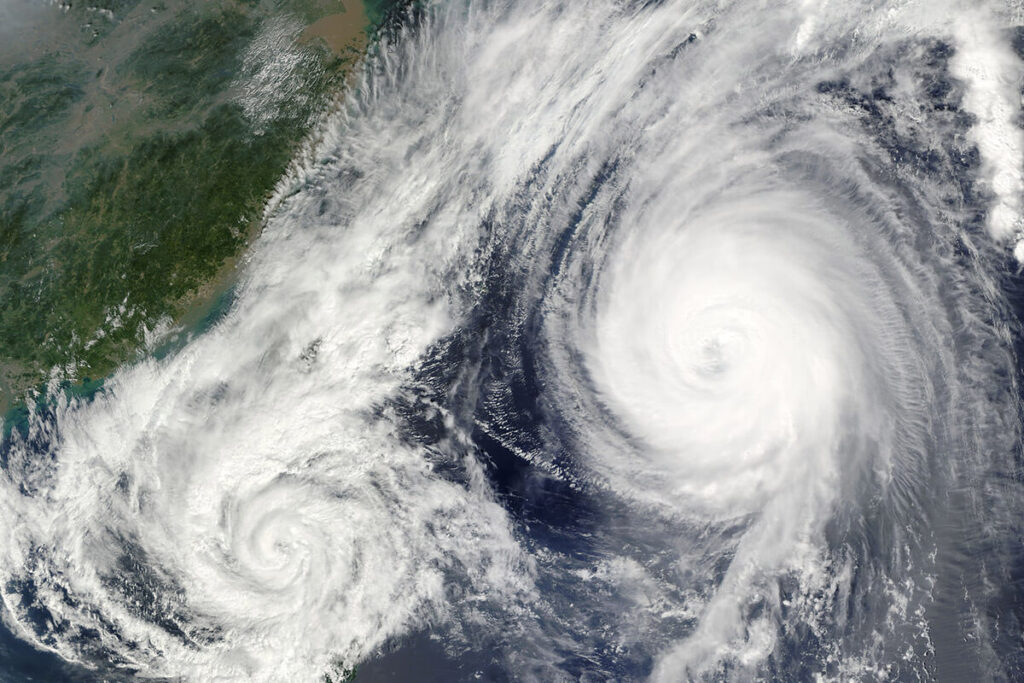
Hurricane Maria
When Hurricane Maria battered the Caribbean in 2017, the damage was indescribable. Antigua and Barbuda’s…
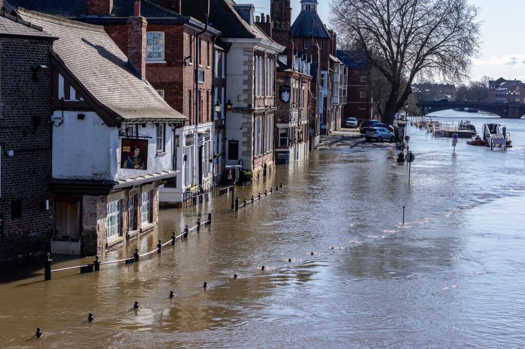
Storm Eva – UK floods
Between Storms Desmond, Eva and Frank, the month of December 2015 was Britain’s wettest in…